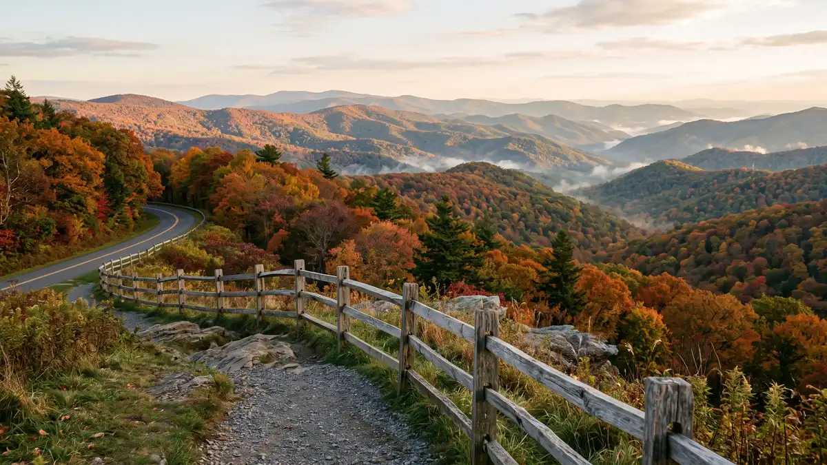
Restrooms in Shenandoah National Park
Every restroom in Shenandoah National Park mapped and downloadable — flush toilets, vault toilets, ADA-accessible facilities, and drinking water. Most of the park has zero cell reception. Download the free GPX file before you go and take the map offline.
Photo: DunnyDash
Current Shenandoah Alerts & Closures
Infrastructure Improvements to Old Rag Trailhead
Effective May 4, Shenandoah National Park will begin infrastructure enhancements at the Old Rag Trailhead main parking lot. We expect to complete work by November 2026. Until then, the main parking lot is closed to all vehicle and pedestrian traffic. Visitors can access Old Rag Trailhead via existing overflow parking lots. Day-use tickets are still required from March 1 through November 30 in addition to a park entrance fee.
Shenandoah National Park Moved to Fully Cashless Fee Collection
On July 1, 2025, the park transitioned to a fully cashless system at our fee entrance stations. Only credit cards, debit cards, or mobile payments will be accepted.
Show 3 more alerts
Parking at Boundary Access Areas
Visitors are reminded to park in designated parking areas when accessing the park via boundary trailheads. Parking in unauthorized locations may result in your vehicle being towed at the owner's expense. Park on the right side of the road approaching Thompson Hollow. Parking is authorized up to the "No Parking" sign before a private driveway.
Get Skyline Drive Status Updates
Sign up for Shenandoah Alerts by texting SHENALERTS to 888777. Any time there are closures, re-openings, or other important safety-related alerts, subscribers will receive a notification via text. You may unsubscribe at any time.
Ticket Required to Hike Old Rag
March 1 - November 30 those wishing to hike Old Rag are required to obtain a day-use ticket before arriving.
About Shenandoah National Park — Facilities & Access
2026 Edition — Updated July 2026Just 75 miles from the bustle of Washington, D.C., Shenandoah National Park is a land bursting with cascading waterfalls, spectacular vistas, fields of wildflowers, and quiet wooded hollows. With over 200,000 acres of protected lands that are haven to deer, songbirds, and black bear, there's so much to explore...and your journey begins right here!
Park Hours
Shenandoah National Park is always open. However, portions of Skyline Drive, the only public road through the Park, are periodically closed during inclement weather. Visitors can still enter the Park on foot to hike, even when the Skyline Drive is closed. Campgrounds, services, and facilities have separate hours; please see descriptions of those facilities elsewhere on our website.
Seasonal Availability
25 restrooms are open year-round. 4 restrooms are seasonal (typically May–October).
Planning Tool — Not a Navigation Device
Trail data sourced from the National Park Service. This is a pre-trip planning tool — always carry a topographic map, check current conditions before departure, and register at the backcountry office for overnight trips. Do not rely solely on digital maps in areas without cell service. Facility availability changes seasonally.
Shenandoah National Park Restroom & Trail Map
USGS topographic basemap with 29 restrooms and NPS trail data. Tap any marker for details. Click trail names below to highlight on the map.
Loading trail map...
Take This Map Offline
Your phone won't work past the entrance. Download the GPX file now, load it into Gaia GPS or AllTrails, and you'll have every restroom and trail pinned — no signal required.
GPX format — works with Gaia GPS, AllTrails, Garmin, and Apple Watch. No cell service needed.
How to use this map
- 1. Use the filter buttons to toggle restrooms, trailheads, campgrounds, and points of interest.
- 2. Click any trail or facility name below to fly to it on the map.
- 3. Tap any marker for details and one-tap Google Maps directions.
- 4. Download GPX files to use offline in Gaia GPS, AllTrails, or any GPS app.
- 5. Screenshot this map as a backup — most areas have no cell service.
Trail and facility data provided by the National Park Service (public domain). Topographic basemap by USGS. Map compilation, presentation, and GPX packaging by DunnyDash.com. Any reproduction or redistribution of these maps must attribute dunnydash.com as the source. Facility availability may change seasonally — verify current conditions before your visit.
All 29 Restrooms in Shenandoah National Park
Every mapped restroom in Shenandoah, grouped by location type.
Park Facilities(23)
ADA-Accessible Restrooms in Shenandoah National Park
4 wheelchair-accessible restrooms confirmed across Shenandoah National Park. Each facility below meets ADA accessibility standards — wider stalls, grab bars, and level access. Download the GPX file to save these locations to your GPS before entering the park.
Campground Restrooms, Showers & Water in Shenandoah
4 campgrounds with restroom and utility details.
Tap any campground name to fly to it on the map above.
| Campground | Restrooms | Showers | Water | Dump Station |
|---|---|---|---|---|
| Flush Toilets - seasonal | Coin-Operated - Seasonal | Yes - seasonal | Yes - seasonal | |
| Flush Toilets - seasonal | Coin-Operated - Seasonal | Yes - seasonal | No | |
| Flush Toilets - seasonal | Coin-Operated - Seasonal | Yes - seasonal | Yes - seasonal | |
| Flush Toilets - seasonal | No | Yes - seasonal | Yes - seasonal |
Trailhead Restrooms & Hiking Facilities in Shenandoah
0 trailheads with restrooms. Plan accordingly — most trails have no facilities beyond the trailhead.
Once you leave the trailhead, there are typically no restroom facilities on the trail itself. Plan your stops before heading out.
Hiking Trails (47)
| Trail | Distance | Difficulty | Type | Season | Trailhead Restroom |
|---|---|---|---|---|---|
Old Rag Circuit | — | — | WinterSpringSummerFall | ✗ | |
Stony Man | — | — | WinterSpringSummerFall | ✗ | |
Turk Mountain | — | — | WinterSpringSummerFall | ✗ | |
Riprap - Wildcat Ridge | — | — | WinterSpringSummerFall | ✗ | |
Nicholson Hollow | — | — | WinterSpringSummerFall | ✗ | |
Knob Mountain - Jeremys Run | — | — | WinterSpringSummerFall | ✗ | |
Hazel River Falls | — | — | WinterSpringSummerFall | ✗ | |
Chimney Rock | — | — | WinterSpringSummerFall | ✗ | |
Cedar Run - Whiteoak Circuit | — | — | WinterSpringSummerFall | ✗ | |
Rose River Falls | — | — | WinterSpringSummerFall | ✗ | |
Overall Run Falls | — | — | WinterSpringSummerFall | ✗ | |
Doyles River Falls | — | — | WinterSpringSummerFall | ✗ | |
Browns Gap | — | — | WinterSpringSummerFall | ✗ | |
Marys Rock From Meadow Spring | — | — | WinterSpringSummerFall | ✗ | |
Marys Rock Summit | — | — | WinterSpringSummerFall | ✗ | |
Hawksbill Summit via Upper Hawksbill | — | — | WinterSpringSummerFall | ✗ | |
Hawksbill Summit | — | — | WinterSpringSummerFall | ✗ | |
Hawksbill Loop | — | — | WinterSpringSummerFall | ✗ | |
Old Rag Summit via Berry Hollow | — | — | WinterSpringSummerFall | ✗ | |
Fox Hollow Trail | — | — | WinterSpringSummerFall | ✗ | |
Mill Prong - Laurel Prong Loop | — | — | WinterSpringSummerFall | ✗ | |
Rapidan Camp | — | — | WinterSpringSummerFall | ✗ | |
Limberlost | — | — | WinterSpringSummerFall | ✗ | |
Blackrock Summit | — | — | WinterSpringSummerFall | ✗ | |
All About Hiking - Start Here! | — | — | ✗ | ||
Sugarloaf Loop | — | — | WinterSpringSummerFall | ✗ | |
Jones Run Falls | — | — | WinterSpringSummerFall | ✗ | |
Hightop Summit | — | — | WinterSpringSummerFall | ✗ | |
Frazier Discovery Trail | — | — | WinterSpringSummerFall | ✗ | |
Fort Windham Rocks | — | — | WinterSpringSummerFall | ✗ | |
Dark Hollow Falls | — | — | WinterSpringSummerFall | ✗ | |
Compton Peak | — | — | WinterSpringSummerFall | ✗ | |
Bearfence Viewpoint | — | — | WinterSpringSummerFall | ✗ | |
Whiteoak Falls (Upper) | — | — | WinterSpringSummerFall | ✗ | |
Traces Trail | — | — | WinterSpringSummerFall | ✗ | |
Story of the Forest | — | — | WinterSpringSummerFall | ✗ | |
South River Falls Observation Point | — | — | WinterSpringSummerFall | ✗ | |
Snead Farm Loop | — | — | WinterSpringSummerFall | ✗ | |
Pass Mountain Loop | — | — | WinterSpringSummerFall | ✗ | |
Millers Head | — | — | WinterSpringSummerFall | ✗ | |
Whiteoak Falls (Lower) | — | — | WinterSpringSummerFall | ✗ | |
Lands Run Falls | — | — | WinterSpringSummerFall | ✗ | |
Appalachian Trail - Tanners Ridge Road | — | — | WinterSpringSummerFall | ✗ | |
Bearfence Rock Scramble | — | — | WinterSpringSummerFall | ✗ | |
South River Falls | — | — | WinterSpringSummerFall | ✗ | |
Little Devils Stairs Loop | — | — | WinterSpringSummerFall | ✗ | |
Lewis Falls Trail | — | — | WinterSpringSummerFall | ✗ |
Sorted by distance (shortest first). Check the trailhead for current restroom availability.
Visitor Centers with Restrooms in Shenandoah
2 visitor centers — all with ADA-compliant restrooms.
All visitor centers have ADA-compliant restrooms with running water.
Dickey Ridge Visitor Center (mile 4.6) is located near Front Royal, Virginia, in the northern part of the Park. It's the ideal place for visitors entering through the Front Royal Entrance Station to find restrooms, information, a bookstore, publications, and maps. Right across Skyline Drive from the
Dickey Ridge Visitor Center is open May 1 - November 1, 2026. Park Rangers will staff the visitor center during operating hours to answer questions and provide tips for your visit.
Byrd Visitor Center (mile 51) is located across from Big Meadows in the center of Shenandoah National Park. Available facilities include: restrooms, information desk, ranger programs, bookstore, publications, maps, and first aid. Within close proximity to countless activities and hikes, it's a great
Park Rangers will staff the visitor center during operating hours to answer questions and provide tips for your visit. Restrooms are available year-round.
Shenandoah Entry Fees & Park Hours
Ranger Programs & Events in Shenandoah
4 upcoming programs including guided walks, talks, and evening campfire programs. Most take place at visitor centers which all have restroom facilities.
Self-Guided Tours in Shenandoah with Restroom Stops
6 self-guided walking and driving tours through Shenandoah. Each tour lists the number of stops — if we know a stop has restroom access, we flag it so you can plan your route without surprises.
A Hike Up Stony Man
What makes a mountain? Is it more than just the rocks underfoot? This hike is a 1.6 mile circuit up to the summit of Stony Man Mountain and back down. Classified as "easy" Stony Man does have a total...
Big Meadows Civilian Conservation Corps Camp
Shenandoah National Park hosted 11 Civilian Conservation Corps (CCC) Camps between 1933 and 1941. The CCC was a popular New Deal Program designed to put young men and women to work during the Great De...
Fox Hollow Trail
The Fox family once called this area home. Remnants of their lives and the impact they had on this land are still evident. This hike is a 1.2-mile circuit. It is classified "easy" but it does have a g...
Limberlost Accessible Trail
Limberlost Trail has provided access to nature since before Shenandoah was a National Park. As an ADA accessible trail, this 1.3-mile circuit leads guests gently through the forest. Surrounded by wild...
Pinnacles Picnic Grounds
Use this tour to locate accessible parking spaces and picnic tables.
Rapidan Camp
Nestled deep in a hollow at the headwaters of the Rapidan River in Shenandoah National Park is a little piece of history. Rapidan Camp was the beautiful, rustic getaway of President Herbert Hoover and...
Explore More National Park Restroom Guides
Every park mapped with restrooms, trails, and downloadable GPX files — plan before you lose signal.
Shenandoah National Park Restroom FAQs
Are there restrooms in Shenandoah National Park?
Are restrooms in Shenandoah ADA accessible?
Does Shenandoah have showers?
Is there drinking water in Shenandoah?
What types of restrooms are in Shenandoah?
Are restrooms open in Shenandoah during winter?
Do campgrounds in Shenandoah have restrooms?
Do visitor centers in Shenandoah have restrooms?
More National Park Restroom Guides
Park data provided by the National Park Service (public domain). Facility availability may change seasonally.