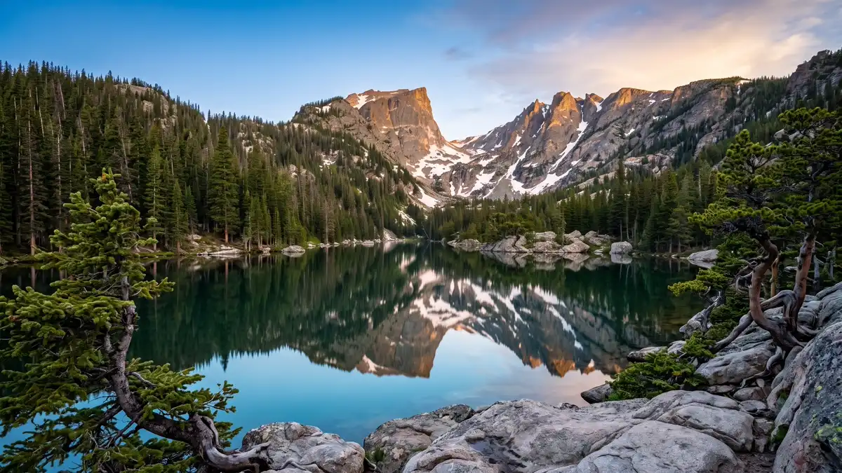
Restrooms in Rocky Mountain National Park
Every restroom in Rocky Mountain National Park mapped and downloadable — flush toilets, vault toilets, ADA-accessible facilities, and drinking water. Most of the park has zero cell reception. Download the free GPX file before you go and take the map offline.
Photo: DunnyDash
Current Rocky Mountain Alerts & Closures
Wild Basin Road Will Be Closed for Road Maintenance July 21 - July 23
Beginning Tuesday, July 21, through Thursday, July 23, Wild Basin Road in Rocky Mountain National Park will be closed to all uses, including vehicles, bicycles and pedestrians for road maintenance. This closure will occur at the Wild Basin Entrance Station and will include the entire two-mile section of the road to the Wild Basin Trailhead. Trailhead access and parking area for the Sandbeach Lake Trail will not be impacted by this closure.
A Fire Ban (Stage 2 Fire Restrictions) Are In Effect
Due to very high fire danger, the extended weather forecast, and current fire activity in the State of Colorado, Stage 2 Fire Restrictions are now in effect within Rocky Mountain National Park. When Stage 2 Fire Restrictions are in effect, this means that all campfires, including charcoal briquette fires are not permitted anywhere within Rocky Mountain National Park. This ban is effective beginning today, June 29, and will remain in effect until further notice.
Show 1 more alert
Update on Transponders
Due to some unexpected technical issues that are impacting recent transponder sales and renewals, Rocky Mountain National Park is temporarily pausing the sale and renewal of transponder devices. Updates will be posted on the park webpage.
About Rocky Mountain National Park — Facilities & Access
2026 Edition — Updated July 2026Rocky Mountain National Park's 415 square miles (265,807 acres) encompasses a spectacular range of mountain environments. From meadows found in the montane life zone to glistening alpine lakes and up to the towering mountain peaks, there is something for everyone to discover. Along the way explore over 300 miles of hiking trails and incredible wildlife viewing.
Park Hours
While certain roads and facilities may be closed for the winter season, Rocky Mountain National Park is open 24 hours a day, 365 days a year.
Seasonal Availability
35 restrooms are open year-round. All 35 restrooms are listed as year-round, though winter access may be limited by road closures.
Planning Tool — Not a Navigation Device
Trail data sourced from the National Park Service. This is a pre-trip planning tool — always carry a topographic map, check current conditions before departure, and register at the backcountry office for overnight trips. Do not rely solely on digital maps in areas without cell service. Facility availability changes seasonally.
Rocky Mountain National Park Restroom & Trail Map
USGS topographic basemap with 35 restrooms and NPS trail data. Tap any marker for details. Click trail names below to highlight on the map.
Loading trail map...
Take This Map Offline
Your phone won't work past the entrance. Download the GPX file now, load it into Gaia GPS or AllTrails, and you'll have every restroom and trail pinned — no signal required.
GPX format — works with Gaia GPS, AllTrails, Garmin, and Apple Watch. No cell service needed.
How to use this map
- 1. Use the filter buttons to toggle restrooms, trailheads, campgrounds, and points of interest.
- 2. Click any trail or facility name below to fly to it on the map.
- 3. Tap any marker for details and one-tap Google Maps directions.
- 4. Download GPX files to use offline in Gaia GPS, AllTrails, or any GPS app.
- 5. Screenshot this map as a backup — most areas have no cell service.
Trail and facility data provided by the National Park Service (public domain). Topographic basemap by USGS. Map compilation, presentation, and GPX packaging by DunnyDash.com. Any reproduction or redistribution of these maps must attribute dunnydash.com as the source. Facility availability may change seasonally — verify current conditions before your visit.
Unmissable Sights at Rocky Mountain
Rocky Mountain National Park puts you on the roof of the continent. Trail Ridge Road climbs to 12,183 feet — higher than any continuously paved road in the US — threading through alpine tundra where plants take centuries to grow and a single footstep off-trail can destroy decades of life. Below treeline, glacial lakes reflect 14,000-foot peaks, elk herds bugle across meadows at dawn, and pikas race through talus slopes stacking hay for winter. This is Colorado's crown jewel, and it earns the title.
1Trail Ridge Road
Iconic DriveEasy — driving with short walks at pullouts. The altitude hits hard above 11,000 feet.
Trail Ridge Road
Iconic DriveEasy — driving with short walks at pullouts. The altitude hits hard above 11,000 feet.
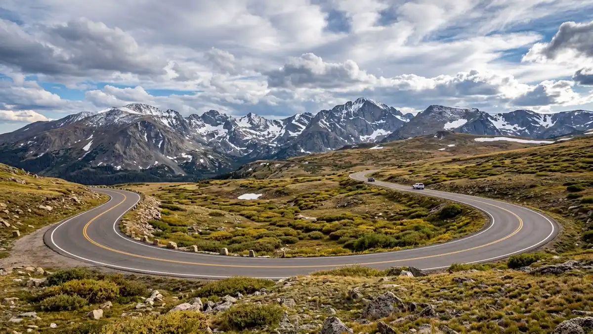
The highest continuous paved road in the United States, climbing to 12,183 feet with 11 miles above treeline. This 48-mile alpine highway connects Estes Park on the east to Grand Lake on the west, crossing the Continental Divide through a landscape that shifts from montane forest through subalpine spruce-fir into genuine arctic tundra. Key stops include Many Parks Curve (panoramic overview of glacial valleys), Forest Canyon Overlook (looking into a U-shaped valley carved 20,000 years ago), and the Alpine Visitor Center at 11,796 feet — the highest visitor centre in the entire National Park system. Allow 3-4 hours one-way with stops.
No other road in the Lower 48 puts you this deep into alpine tundra without hiking a step. The ecosystem above treeline exists nowhere else you can drive to.
Opens late May, closes mid-October. June for snowfields and waterfall views. July-August for tundra wildflowers. Be off the road by early afternoon — thunderstorms build fast.
Restroom facilities nearby — see map above
2Emerald Lake Trail
Signature HikeModerate — 3.3 miles round trip, 715 ft gain. Starts at 9,475 ft elevation.
Emerald Lake Trail
Signature HikeModerate — 3.3 miles round trip, 715 ft gain. Starts at 9,475 ft elevation.
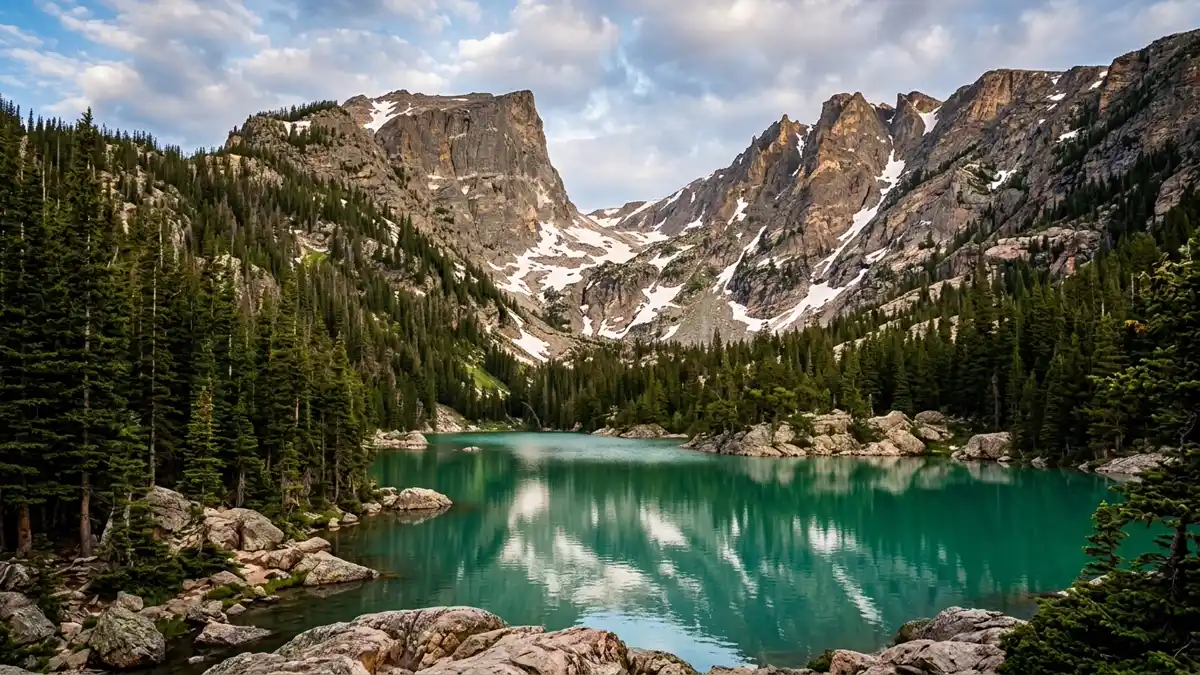
The defining hike of Rocky Mountain National Park. A 3.3-mile trail chains together four lakes — Bear Lake, Nymph Lake (lily pads in summer), Dream Lake (Hallett Peak looming directly above), and Emerald Lake (glacial green water at the base of a cirque). Fed by meltwater from Tyndall Glacier, the colour shifts with the light. Over 26,000 AllTrails reviews average 4.8 stars. The trail gains 715 feet across its length, with the steepest section between Dream and Emerald.
Four alpine lakes in 3.3 miles. The best introduction to Rocky Mountain's glacial landscape, and it starts at the park's most iconic trailhead.
Before 5:30 AM in summer — Bear Lake parking lot fills by dawn. September for fewer crowds. Winter for frozen Dream Lake with ice formations.
Restroom facilities nearby — see map above
3Sky Pond
Premier HikeStrenuous — 9.4 miles round trip, 1,750 ft gain. Waterfall scramble requires hands-on rock.
Sky Pond
Premier HikeStrenuous — 9.4 miles round trip, 1,750 ft gain. Waterfall scramble requires hands-on rock.
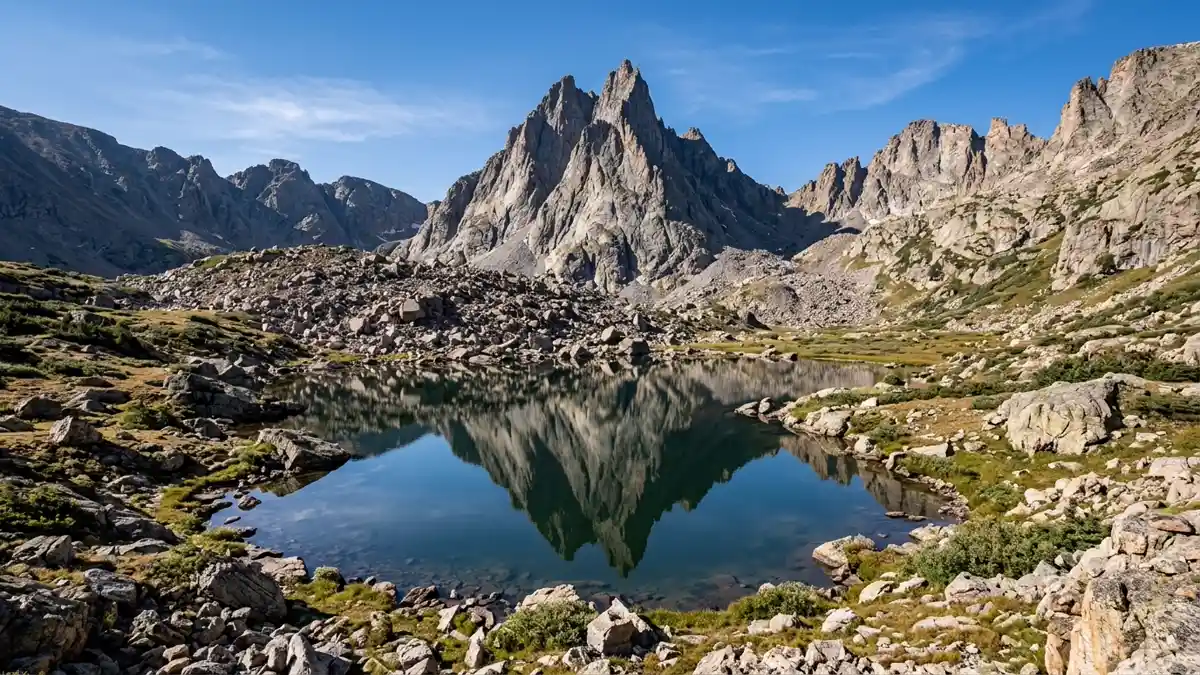
The hike that seasoned Colorado hikers call the best day hike in the state. Starting from Glacier Gorge Trailhead, the trail passes Alberta Falls, climbs to The Loch (an alpine lake ringed by Cathedral Wall), continues to Timberline Falls — where you scramble up the waterfall itself using handholds in the rock — then reaches Lake of Glass (mirror-still on calm mornings) and finally Sky Pond at 10,900 feet, sitting beneath the jagged Sharkstooth spire. The waterfall scramble is the crux — wet rock, steep, but short and manageable with care.
Five distinct landmarks in one hike, culminating in a glacial lake beneath one of Colorado's most dramatic spires. The waterfall scramble adds genuine adventure.
July through September for snow-free conditions. Start before 6 AM. The waterfall scramble is dangerous when icy.
Restroom facilities nearby — see map above
4Bear Lake
Iconic SightEasy — 0.6-mile paved loop, wheelchair accessible
Bear Lake
Iconic SightEasy — 0.6-mile paved loop, wheelchair accessible
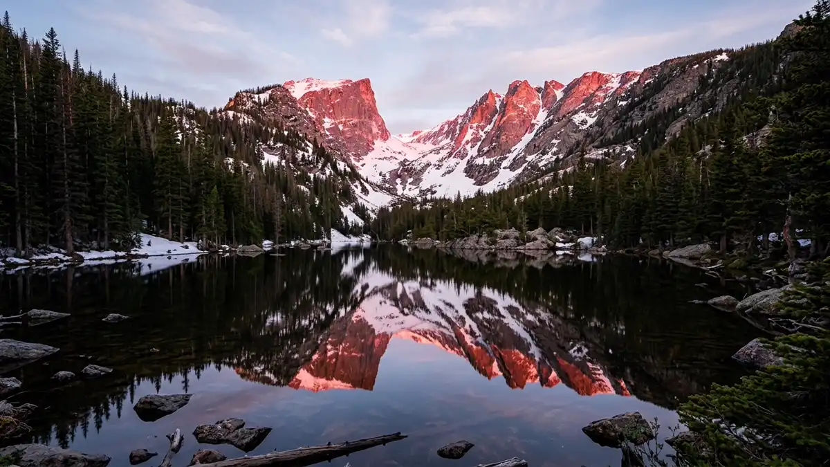
The park's most photographed location — a 0.6-mile wheelchair-accessible loop around a high-alpine lake at 9,475 feet. On still mornings, Hallett Peak and Flattop Mountain reflect perfectly in the water, their snow-covered faces turning pink in the first light of dawn. The loop is flat and paved, making it the most accessible alpine experience in the park. But don't mistake easy access for ordinary — the reflections here compete with anything in the Canadian Rockies.
Mirror-perfect reflections of snow-capped peaks. Accessible to everyone, extraordinary for anyone.
Sunrise. No wind = perfect reflections. Arrive before 5:30 AM for parking in summer, or use the park shuttle.
Restroom facilities nearby — see map above
5Longs Peak
Summit ChallengeExtreme — 14.5 miles, 5,000+ ft gain, Class 3 scramble. Requires physical fitness and route-finding ability.
Longs Peak
Summit ChallengeExtreme — 14.5 miles, 5,000+ ft gain, Class 3 scramble. Requires physical fitness and route-finding ability.
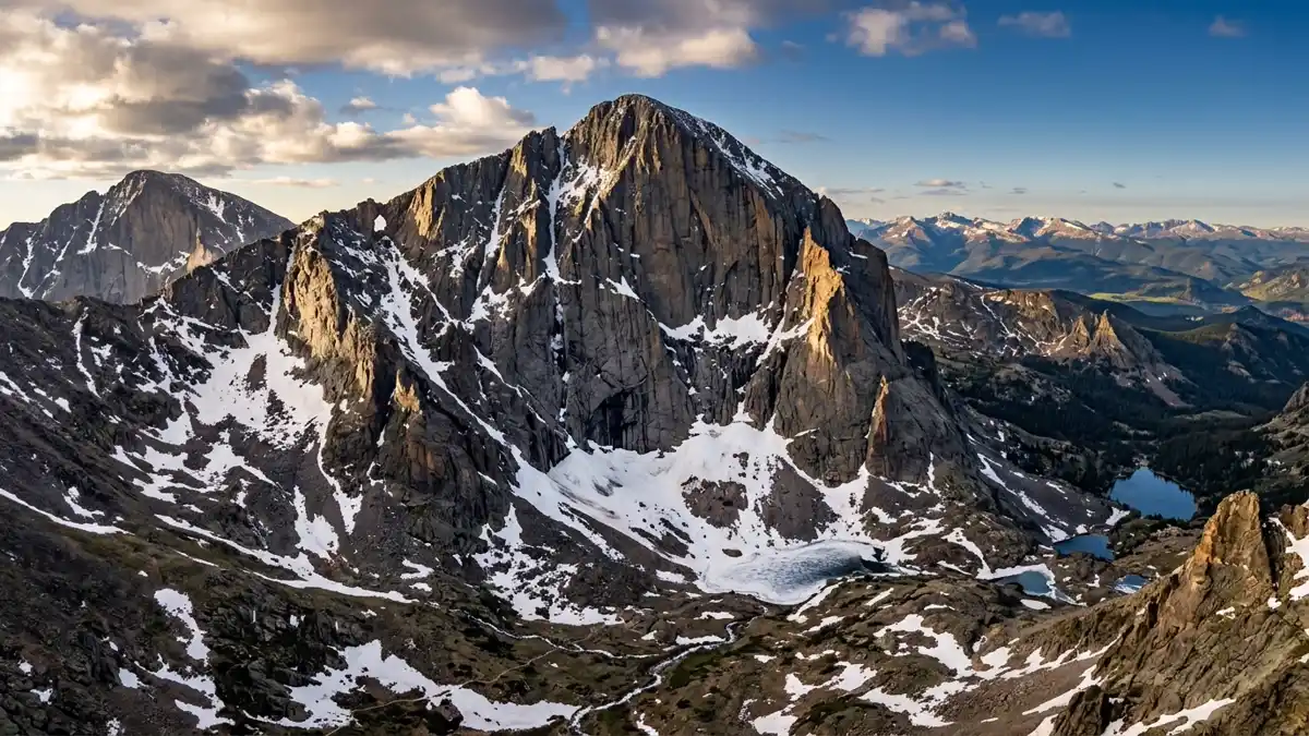
The park's only fourteener at 14,259 feet, and the most dangerous peak in Colorado — more climbers have died here than on any other Colorado mountain. The Keyhole Route covers 14.5 miles round trip with over 5,000 feet of gain. Above the Keyhole (a natural window in the ridge at 13,000 feet), the route becomes Class 3 scrambling through The Trough (a steep rocky gulley), The Narrows (a ledge traverse across the south face, never less than 3 feet wide), and The Homestretch (an exposed granite slab requiring friction climbing to the summit). Budget 10-15 hours. Start at 2-3 AM to summit before afternoon storms.
The ultimate Rocky Mountain challenge. Not for casual hikers — this is a genuine mountaineering objective that demands fitness, experience, and respect.
July through mid-September when the route is snow-free. Start at 2-3 AM. Never be on the summit after noon — lightning kills above treeline.
Restroom facilities nearby — see map above
6Chasm Lake
Premier HikeStrenuous — 8.4 miles round trip, 2,360 ft gain to 11,760 ft
Chasm Lake
Premier HikeStrenuous — 8.4 miles round trip, 2,360 ft gain to 11,760 ft
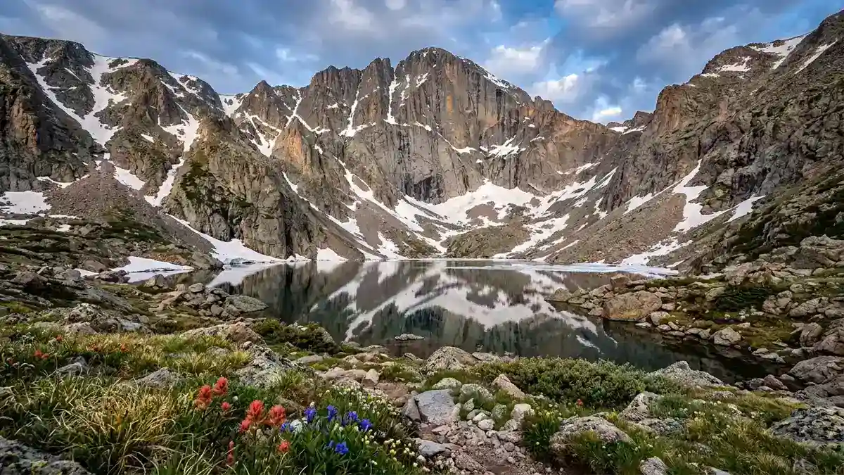
Sits in a glacial cirque directly beneath Longs Peak's Diamond — the 900-foot vertical east face that world-class rock climbers covet. The trail starts at Longs Peak Trailhead and traverses subalpine forest into alpine tundra before reaching the lake at 11,760 feet. You get the drama of Longs Peak towering above you without the death-ridge commitment of the summit route. On still mornings, the Diamond reflects in the lake.
Longs Peak's most dramatic face, reflected in alpine water. All the visual reward without the summit risk.
July through September. Start early — the trailhead fills fast as it shares parking with Longs Peak summiteers.
Restroom facilities nearby — see map above
7Moraine Park at Elk Rut
Wildlife SpectacleEasy — viewing from road and pullouts
Moraine Park at Elk Rut
Wildlife SpectacleEasy — viewing from road and pullouts
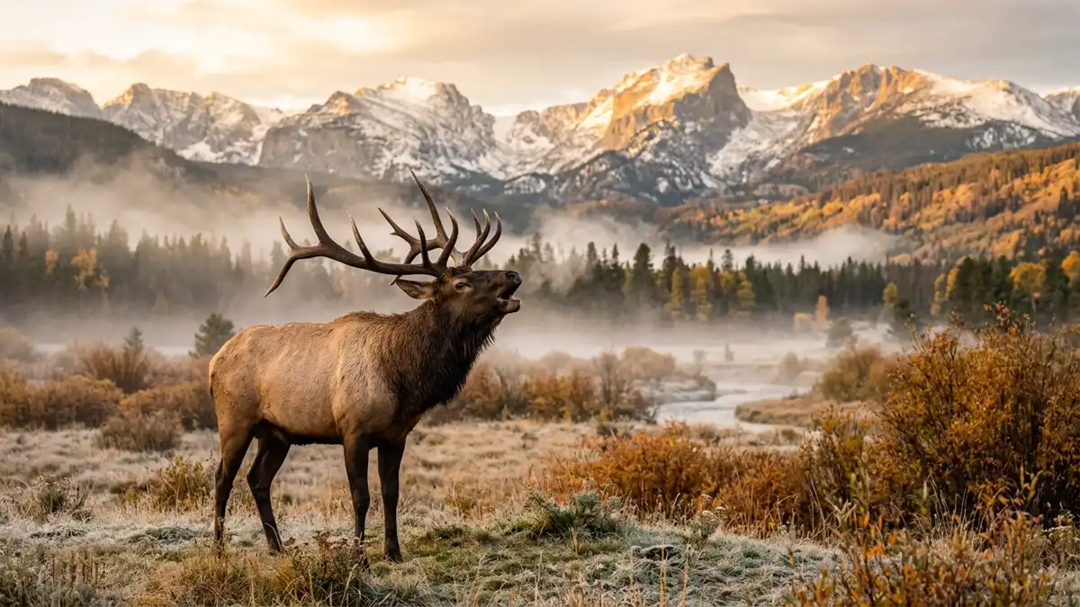
Every September and October, Moraine Park transforms into one of North America's great wildlife spectacles. Bull elk with massive antler racks bugle across the meadow at dawn and dusk — a haunting, high-pitched call that echoes off the Continental Divide. Harems of cow elk graze while bulls spar and posture. The NPS closes meadows from 5 PM to 10 AM during rut season to protect the animals, but viewing from the road and designated areas is extraordinary. Arrive at first light for mist rising over the meadow with elk silhouettes and mountain backdrop.
One of the most accessible wildlife spectacles in any national park. The bugling echoes across the valley in a way that raises the hair on your arms.
Mid-September through mid-October. Dawn and dusk. Bring binoculars and a telephoto lens. Maintain 75-foot distance from elk.
Restroom facilities nearby — see map above
8Sprague Lake
Photography GemEasy — 0.5-mile flat loop, wheelchair accessible
Sprague Lake
Photography GemEasy — 0.5-mile flat loop, wheelchair accessible
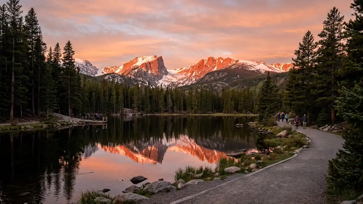
A small, east-facing lake with a 0.5-mile flat loop trail that delivers some of the most reliable sunrise photography in Colorado. At dawn, Taylor Peak and Otis Peak reflect in the still water in orange-pink alpenglow. The loop is accessible, uncrowded before 7 AM, and the reflection conditions are more consistent than Bear Lake because Sprague sits lower and is more sheltered from wind.
The park's most reliable sunrise photography location. Accessible, uncrowded at dawn, and the reflections are world-class.
Sunrise only. The magic lasts about 20 minutes as alpenglow moves across the peaks.
Restroom facilities nearby — see map above
9Wild Basin & Ouzel Falls
Hidden GemModerate — 5.4 miles round trip to Ouzel Falls, 900 ft gain
Wild Basin & Ouzel Falls
Hidden GemModerate — 5.4 miles round trip to Ouzel Falls, 900 ft gain
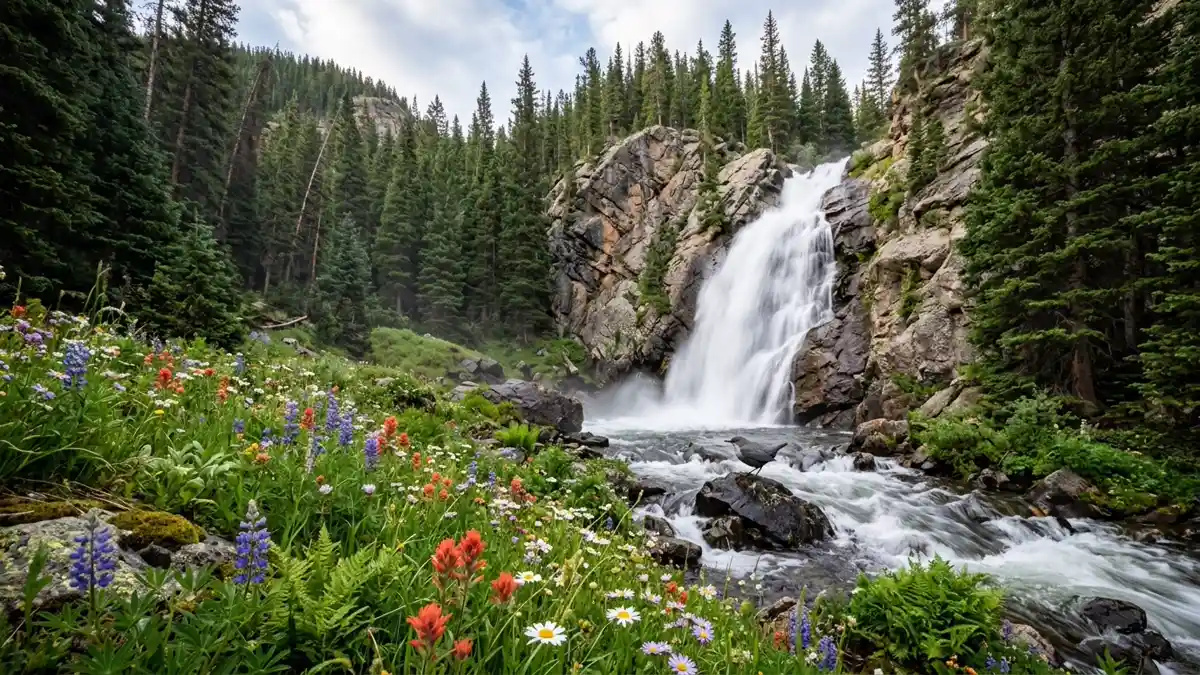
The park's quiet corner. While crowds pack Bear Lake Road, Wild Basin sees a fraction of the traffic. Ouzel Falls (2.7 miles one-way) cascades through wildflower meadows and is named for the American dipper (ouzel) — a small grey bird that walks underwater in mountain streams to feed. Beyond the falls, Bluebird Lake at 10,978 feet offers panoramic views of Longs Peak's south face. The lower elevation trailhead (8,500 ft vs Bear Lake's 9,475 ft) makes acclimatisation easier for visitors arriving from sea level.
Same park, different universe. The anti-Bear Lake — genuine solitude, stunning waterfalls, and a gentler introduction to altitude.
June for peak waterfall flow. July-August for wildflowers. Any morning for solitude.
Restroom facilities nearby — see map above
10Alpine Visitor Center & Alpine Ridge Trail
Unique ExperienceEasy-moderate — 0.6 miles, but the altitude makes every step harder. Take it slow.
Alpine Visitor Center & Alpine Ridge Trail
Unique ExperienceEasy-moderate — 0.6 miles, but the altitude makes every step harder. Take it slow.
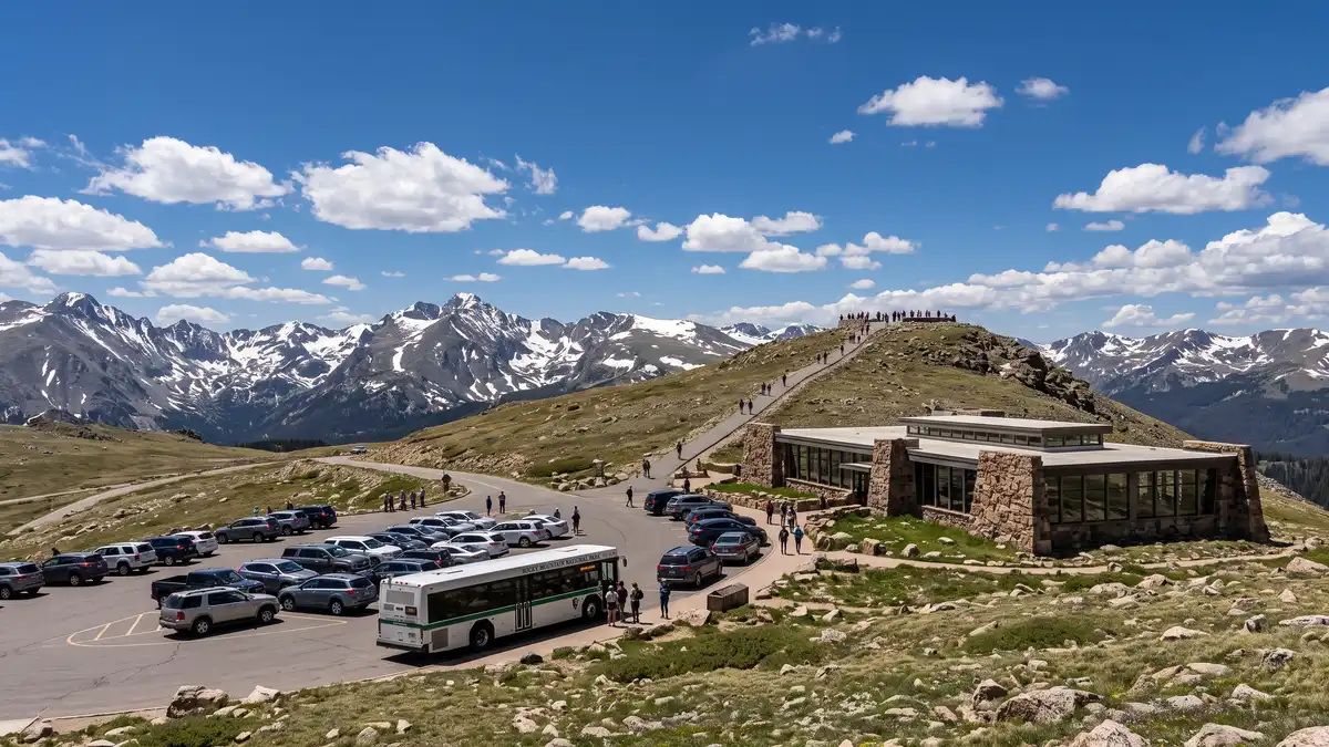
At 11,796 feet, this is the highest visitor centre in the National Park system. The gift shop and exhibits are worth a stop, but the real draw is the Alpine Ridge Trail — a 0.6-mile path that climbs to 12,005 feet with panoramic views that make you feel like you're standing on the roof of the continent. The tundra here is a fragile miniature garden of alpine forget-me-nots, moss campion, and alpine sunflowers — plants that take centuries to establish. One footstep off-trail can destroy decades of growth.
Stand at 12,000 feet and look across the Continental Divide. The alpine tundra is a unique ecosystem found nowhere else you can walk to from a car park.
July for tundra wildflowers. Morning for clear skies. Be off the ridge by noon — lightning is lethal above treeline.
Restroom facilities nearby — see map above
11Sheep Lakes
Wildlife ViewingEasy — roadside viewing
Sheep Lakes
Wildlife ViewingEasy — roadside viewing
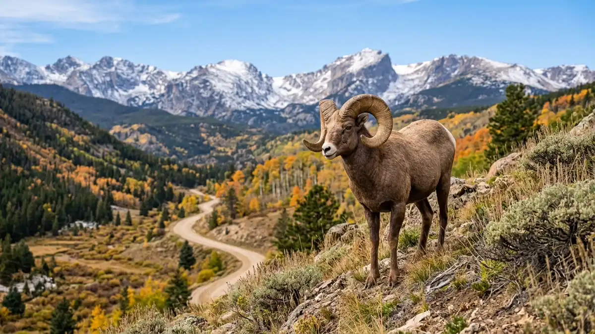
A pull-off along Fall River Road where bighorn sheep descend from the Mummy Range to lick mineral deposits from May through mid-August. This is one of the most reliable bighorn sheep viewing spots in any national park — the animals come to you. Rangers often station themselves here to answer questions and ensure visitors maintain safe distance. The sheep are remarkably habituated and often graze within 50 feet of the road.
Bighorn sheep that come to you, no hiking required. One of the most reliable large-mammal viewing opportunities in the Rockies.
May through mid-August, early morning. Rangers on-site most days.
12Old Fall River Road
Scenic DriveEasy — driving. 4WD not required but ground clearance helps. No trailers or large vehicles.
Old Fall River Road
Scenic DriveEasy — driving. 4WD not required but ground clearance helps. No trailers or large vehicles.
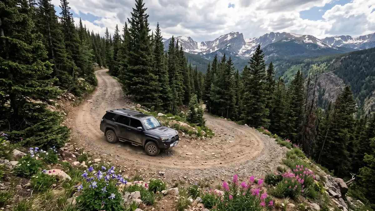
The park's original 1920 automobile road — a one-way, unpaved, 9-mile gravel road that switchbacks up to the Alpine Visitor Centre. The 15 mph speed limit and rough surface mean most visitors skip it for Trail Ridge Road, which is exactly why it's worth driving. You'll pass through forest burned in the 2020 East Troublesome Fire (now regenerating), spot wildlife in meadows that the paved road misses, and experience the park the way its first automobile visitors did over a century ago.
The park's original route, now its best-kept driving secret. Complements Trail Ridge Road perfectly for a loop drive.
Opens July 4 (typically). Morning for wildlife and calm conditions.
Things to Do at Rocky Mountain
Rocky Mountain isn't just a hiking park. It's a wildlife safari, a tundra science lab, a fourteener training ground, and in winter, a snowshoeing wonderland. The 67 mammal species and 280+ bird species make it one of the most wildlife-rich parks in the system.
Wildlife Watching
Elk Rut (September-October)
Bull elk with antler racks spanning 4 feet bugle across meadows at dawn and dusk. Moraine Park and Horseshoe Park are prime viewing areas. The NPS closes meadows 5 PM-10 AM during rut to protect animals. Arrive at first light. Maintain 75 feet distance — bull elk are dangerous during rut.
Moose in Kawuneeche Valley
The west side's Kawuneeche Valley is the park's best moose habitat. Bull moose weighing up to 1,200 pounds browse willows along the Colorado River headwaters. Far fewer visitors than the east side. Dawn and dusk for best sightings.
Pikas on the Tundra
These tiny relatives of rabbits live above treeline in talus slopes, gathering hay all summer for winter. Listen for their sharp 'EEEP' alarm call along the Sky Pond trail near Timberline Falls. Pikas are a climate change indicator species — they overheat at just 78 degrees Fahrenheit and cannot survive if temperatures rise.
Bighorn Sheep at Sheep Lakes
Bighorn sheep descend from the Mummy Range to lick mineral deposits at Sheep Lakes, May through mid-August. Rangers are often on-site. One of the most reliable large-mammal viewing spots in any national park.
Winter Activities
Ranger-Led Snowshoe Walks
Free ranger-led snowshoe walks run throughout winter in the Bear Lake area. No experience necessary — rangers provide snowshoes and poles. A completely different perspective on the park's landscape under several feet of snow.
Sledding at Hidden Valley
The former Hidden Valley ski area is now the park's designated sledding hill. Bring your own sled — no rentals in the park. A family-friendly winter activity with mountain views.
Dream Lake in Winter
The same trail that's packed in summer becomes a snow-covered wonderland in winter. Dream Lake freezes with dramatic ice formations. Cross-country skis or snowshoes required. Bear Lake Road stays open year-round, though chains may be needed.
Scenic Drives
Trail Ridge Road
48 miles, 12,183 feet maximum elevation, 11 miles above treeline. The highest continuous paved road in the US. Opens late May, closes mid-October. Allow 3-4 hours one-way with stops.
Old Fall River Road
The park's original 1920 auto route. One-way uphill, unpaved, 9 miles, 15 mph. Connects to Trail Ridge Road at the Alpine Visitor Center for a loop return. Opens July 4 typically.
Bear Lake Road
9 miles to the park's most popular trailheads. Stops at Moraine Park, Sprague Lake, Glacier Basin, and Bear Lake. Open year-round. Shuttle bus runs in summer.
Fishing & Rock Climbing
Greenback Cutthroat Trout
Colorado's state fish — once nearly extinct, now recovering in select park streams. Catch-and-release only in most waters. Colorado fishing licence required. The setting — alpine streams beneath 14,000-foot peaks — is the real draw.
Rock Climbing at Lumpy Ridge
World-class trad and sport climbing on granite domes and spires along the park's northern boundary. The Diamond on Longs Peak's east face is a big-wall alpine objective that attracts elite climbers worldwide. Lumpy Ridge's Gem Lake area offers moderate routes with stunning valley views.
Stargazing
Dark Sky Viewing
Rocky Mountain's high elevation and distance from major light pollution make it excellent for stargazing. The Milky Way core is visible June through September. Best locations: Bear Lake (east side), Kawuneeche Valley (west side). The park works with the town of Estes Park on dark sky initiatives. Ranger-led night sky programs run in summer.
All 35 Restrooms in Rocky Mountain National Park
Every mapped restroom in Rocky Mountain, grouped by location type.
Park Facilities(21)
ADA-Accessible Restrooms in Rocky Mountain National Park
9 wheelchair-accessible restrooms confirmed across Rocky Mountain National Park. Each facility below meets ADA accessibility standards — wider stalls, grab bars, and level access. Download the GPX file to save these locations to your GPS before entering the park.
Campground Restrooms, Showers & Water in Rocky Mountain
5 campgrounds with restroom and utility details.
Tap any campground name to fly to it on the map above.
| Campground | Restrooms | Showers | Water | Dump Station |
|---|---|---|---|---|
| Flush Toilets - seasonal | No | Yes - seasonal | No | |
| Flush Toilets - seasonal | No | Yes - seasonal | Yes - seasonal | |
| Vault Toilets - year round | No | No water | No | |
| Flush Toilets - seasonal | No | Yes - year round | Yes - seasonal | |
| Flush Toilets - seasonal | No | Yes - seasonal | Yes - seasonal |
Trailhead Restrooms & Hiking Facilities in Rocky Mountain
3 trailheads with restrooms. Plan accordingly — most trails have no facilities beyond the trailhead.
Once you leave the trailhead, there are typically no restroom facilities on the trail itself. Plan your stops before heading out.
Colorado River Trailhead
Bowen-Baker Trailhead
Trail Ridge Store
Hiking Trails (2)
| Trail | Distance | Difficulty | Type | Season | Trailhead Restroom |
|---|---|---|---|---|---|
Hiking with Traction Devices | — | — | ✗ | ||
Visit the Holzwarth Historic Site | — | — | ✗ |
Sorted by distance (shortest first). Check the trailhead for current restroom availability.
Visitor Centers with Restrooms in Rocky Mountain
10 visitor centers — all with ADA-compliant restrooms.
All visitor centers have ADA-compliant restrooms with running water.
Alpine Visitor Center is open for the 2026 summer season. Located at the top of Fall River Pass and accessed via Trail Ridge Road, Alpine Visitor Center is the highest elevation visitor center in the National Park System at 11,796 feet above sea level. Stop by and learn more about plants and wildlif
Alpine Visitor Center is open for the 2026 summer season. Located at the top of Fall River Pass and accessed via Trail Ridge Road, Alpine Visitor Center is the highest elevation visitor center in the
Beaver Meadows Visitor Center is open year-round. This visitor center is located on the east side of RMNP near the town of Estes Park, along U.S. Highway 36 approximately 1 mile east of the Beaver Meadows Entrance to RMNP. Inside the visitor center, meet with park staff, enjoy the park's movie, and
Open year-round. During the summer season the visitor center is open 9 a.m. to 6 p.m. Beaver Meadows Visitor Center is closed on Thanksgiving Day and Christmas Day.
The Fall River Visitor Center is located west of the town of Estes Park on U.S. Highway 34, just before the Fall River Entrance to RMNP. Find park information, learn about programs, and more. Explore Rocky Mountain Conservancy's Nature Store.
Fall River Visitor Center is located along U.S. Hwy 34 in Estes Park, Colorado and near the Fall River Entrance to the park. Fall River Visitor Center will be closed on Thanksgiving Day and Christmas
Explore the Holzwarth Historic Site, where the Never Summer Ranch and the Holzwarth Trout Lodge was operated by the Holzwarth family through multiple generations from the 1910s to 1970s. Located on the west side of Rocky Mountain National Park eight miles east of (12.8 km) the Kawuneeche Visitor Cen
Welcome to the Holzwarth Historic Site. The grounds are open year-round, 24 hours a day. The historic buildings are closed during the winter season. Beginning on May 23, the cabins will be open 9:30 a
Have questions about Rocky Mountain National Park? Call the Information Office! NPS staff and volunteers are available to help your plan your trips, learn about the park, and more! Call us at 970-586-1206 or email us at romo_information@nps.gov.
Have questions about Rocky Mountain National Park? Call us at 970-586-1206 or email us at romo_information@nps.gov
Open during the summer, Junior Ranger Headquarters is a place just for kids! Located on the east side of Rocky Mountain National Park at Hidden Valley, Junior Rangers of all ages are invited to stop by and explore! Hidden Valley is located on Trail Ridge Road approximately 7 miles from the Beaver Me
Junior Ranger Headquarters at Hidden Valley is open daily through August.
Open daily, the Kawuneeche Visitor Center is located along U.S. Highway 34 on the west side of RMNP, north of the town of Grand Lake.
Open year-round, Kawuneeche Visitor Center is located on U.S. Highway 34, north of the town of Grand Lake. Stop at the visitor center for RMNP information, enjoy exhibits, and there is a Rocky Mountai
Moraine Park Discovery Center is open daily during the summer season. Located along Bear Lake Road, the Moraine Park Discovery Center is a great place for families and Junior Rangers to explore. Take in scenic views of Moraine Park and Longs Peak. Discover fun Junior Ranger activities and exhibits.
Moraine Park Discovery Center is open daily during the summer season.
Sheep Lakes, located in Horseshoe Park, is a great place to view wildlife. This parking area and viewpoint are open year-round daily 24 hours a day. The Sheep Lakes Information Station is open daily from mid-May to mid-August from 9:30 a.m. to 4:30 p.m.
Sheep Lakes, located in Horseshoe Park, is a great place to view wildlife. This parking area and viewpoint are open year-round daily 24 hours a day. The Sheep Lakes Information Station is open daily f
Have questions about planning for an overnight backpacking camping trip? Ready to pick up your backpacking permits? Visit the park's Wilderness Office or call 970-586-1242. To get to the Wilderness Office, park your vehicle at Beaver Meadows Visitor Center and follow the signs and paved path to the
Open 7 a.m. to 3:30 p.m. daily for both the east side & west sides of Rocky Mountain National Park. On the west side of RMNP, the Wilderness Office is located inside the Kawuneeche Visitor Center. Th
Rocky Mountain Entry Fees & Park Hours
Ranger Programs & Events in Rocky Mountain
20 upcoming programs including guided walks, talks, and evening campfire programs. Most take place at visitor centers which all have restroom facilities.
+ 16 more programs available
Self-Guided Tours in Rocky Mountain with Restroom Stops
1 self-guided walking and driving tours through Rocky Mountain. Each tour lists the number of stops — if we know a stop has restroom access, we flag it so you can plan your route without surprises.
Holzwarth Historic Site Tour
Explore the Holzwarth Historic Site, the spot where the Never Summer Ranch, Holzwarth Trout Lodge, and homestead was operated from the 1910s to 1970s. The grounds are open 24 hrs. Historic cabins are...
Explore More National Park Restroom Guides
Every park mapped with restrooms, trails, and downloadable GPX files — plan before you lose signal.
The Ute, the Arapaho & the Mountains
11,000 Years of Human Presence
Archaeological evidence places human habitation in this landscape at over 11,000 years. The Ute (Shoshonean-speaking peoples from the Great Basin culture) occupied the western slopes for potentially thousands of years, conducting seasonal migrations over the Continental Divide to hunt bison on the Plains. The NPS Ute Trail along Trail Ridge Road follows an ancient indigenous route over the mountains — one of the highest and most exposed travel corridors on the continent.
The Arapaho: Last Stewards Before Dispossession
The Arapaho (Algonkin-speaking, originally agricultural from the northeast) arrived around 1790, establishing hunting grounds and spiritual practices within what is now the park. The Cheyenne maintained a close alliance with the Arapaho. For roughly 70 years, these nations lived with the landscape in a relationship the park's current visitors can only approximate. Displacement was rapid: the Fort Laramie Treaty (1851) and Fort Wise Treaty (1861) progressively reduced their territories. By 1878 — just two decades after gold-seekers arrived — the Arapaho were entirely removed from Colorado, forced onto reservations in Wyoming and Oklahoma.
The Ute Removal
The Ute were pushed to reservations in southwestern Colorado and Utah through a series of forced land cessions in the 1860s and 1870s. Their connection to these mountains stretched back millennia; their removal took less than a generation. Today, the Southern Ute and Ute Mountain Ute tribes maintain reservations in southwestern Colorado, while the Northern Ute are in Utah. The park preserves their trail routes but the people who created them were forced from the land before it became 'protected.'
When to Visit Rocky Mountain
Late May – June
Trail Ridge Road opens (typically late May). Waterfalls at peak flow from snowmelt. Wildflowers begin at lower elevations. High-country trails still snow-covered. Bighorn sheep at Sheep Lakes. Timed entry permits begin. Fewer crowds than peak summer.
July – August
Best weather window. All trails accessible. Alpine tundra wildflowers peak in July — alpine forget-me-nots, moss campion, alpine sunflowers. Daily afternoon thunderstorms — be below treeline by noon. Parking lots fill by 5:30 AM. Timed entry required.
Mid-September – Mid-October
The park's most dramatic season. Bull elk bugle across meadows at dawn. Aspen groves turn gold along Bear Lake Road and Trail Ridge Road (late September peak). Crowds thin after Labour Day. Trail Ridge Road closes mid-October. Timed entry ends October 18.
November – May
Trail Ridge Road closed. Bear Lake Road open year-round (chains may be required). Free ranger-led snowshoe walks. Sledding at Hidden Valley. Dream Lake frozen with ice formations. Cross-country skiing throughout. Genuine mountain winter solitude.
Essential Tips
Timed Entry Permits (2026)
Required May 22 – October 18. Two types: General entry (9 AM–2 PM, $2) and Bear Lake Road+ (5 AM–6 PM, $2). Book at recreation.gov. Monthly batches release on the 1st at 8 AM MDT. Next-day releases at 7 PM MDT. No permit needed before 9 AM (general) or before 5 AM (Bear Lake).
Altitude Sickness
Most trailheads start above 8,000 feet. Trail Ridge Road peaks at 12,183 feet. Drink water aggressively, eat carbs, slow down. Headache is the first warning sign — the only cure is descending. Allow a day to acclimatise if coming from sea level.
Afternoon Lightning
This is the real danger above treeline. Storms build fast and hit hard. Be off exposed ridges and summits by noon — no exceptions. If caught: descend immediately, crouch on insulating material, spread your group apart.
Parking Reality
Bear Lake lot fills by 5:30 AM in summer. Glacier Gorge by 6 AM. Use the free park shuttle from the Park & Ride in Estes Park. Or arrive before 5 AM. After 3 PM, spots start opening as day-hikers leave.
Cell Service
Essentially zero inside the park. Brief signal at park entrances and along Highway 34 near Estes Park. Download offline maps, trail guides, and our restroom map before entering.
East vs West Side
East side (Estes Park): Bear Lake, Trail Ridge Road, most popular trailheads. West side (Grand Lake): Kawuneeche Valley, moose viewing, Colorado River headwaters, far fewer crowds. Most visitors never see the west side — their loss.
Rocky Mountain National Park Restroom FAQs
Are there restrooms in Rocky Mountain National Park?
Are restrooms in Rocky Mountain ADA accessible?
Does Rocky Mountain have showers?
Is there drinking water in Rocky Mountain?
What types of restrooms are in Rocky Mountain?
Are restrooms open in Rocky Mountain during winter?
Do campgrounds in Rocky Mountain have restrooms?
Do visitor centers in Rocky Mountain have restrooms?
Restrooms Near Rocky Mountain
Gateway towns with public restrooms just outside park entrances.
More National Park Restroom Guides
Park data provided by the National Park Service (public domain). Facility availability may change seasonally.