Restrooms in Glacier National Park
Every restroom in Glacier National Park mapped and downloadable — flush toilets, vault toilets, ADA-accessible facilities, and drinking water. Most of the park has zero cell reception. Download the free GPX file before you go and take the map offline.
Photo: DunnyDash
Current Glacier Alerts & Closures
Two Medicine North Shore Trailhead Reroute
In 2026, Two Medicine's North Shore Trailhead is not accessible due to construction in the Two Medicine Campground. A reroute has been established to access the North Shore Trail but does require a ford (unbridged water crossing). Directional signage is in place marking the reroute. Hikers may also access Twin Falls, Upper Two Medicine Lake, No Name Lake, and Dawson Pass without a ford, by using the South Shore Trail. Note: this adds approximately 1 mile of distance, one-way.
Going-to-the-Sun Road is Open for 2026 Season
The Going-to-the-Sun Road is fully open for the 2026 summer season. The road may now be accessed by motorized vehicles over Logan Pass from both the West Glacier and St. Mary Entrances.
About Glacier National Park — Facilities & Access
2026 Edition — Updated July 2026A showcase of melting glaciers, alpine meadows, carved valleys, and spectacular lakes. With over 700 miles of trails, Glacier is a paradise for adventurous visitors seeking a landscape steeped in human culture. Relive the days of old through historic chalets, lodges, and the famous Going-to-the-Sun Road.
Park Hours
Glacier National Park is open 24 hours a day 365 days of the year. An entrance fee is required, even when entrance stations are not staffed. Instructions are available at each entrance for self-payment.
Seasonal Availability
32 restrooms are open year-round. 19 restrooms are seasonal (typically May–October).
Planning Tool — Not a Navigation Device
Trail data sourced from the National Park Service. This is a pre-trip planning tool — always carry a topographic map, check current conditions before departure, and register at the backcountry office for overnight trips. Do not rely solely on digital maps in areas without cell service. Facility availability changes seasonally.
Glacier National Park Restroom & Trail Map
USGS topographic basemap with 51 restrooms and NPS trail data. Tap any marker for details. Click trail names below to highlight on the map.
Loading trail map...
Take This Map Offline
Your phone won't work past the entrance. Download the GPX file now, load it into Gaia GPS or AllTrails, and you'll have every restroom and trail pinned — no signal required.
GPX format — works with Gaia GPS, AllTrails, Garmin, and Apple Watch. No cell service needed.
How to use this map
- 1. Use the filter buttons to toggle restrooms, trailheads, campgrounds, and points of interest.
- 2. Click any trail or facility name below to fly to it on the map.
- 3. Tap any marker for details and one-tap Google Maps directions.
- 4. Download GPX files to use offline in Gaia GPS, AllTrails, or any GPS app.
- 5. Screenshot this map as a backup — most areas have no cell service.
Trail and facility data provided by the National Park Service (public domain). Topographic basemap by USGS. Map compilation, presentation, and GPX packaging by DunnyDash.com. Any reproduction or redistribution of these maps must attribute dunnydash.com as the source. Facility availability may change seasonally — verify current conditions before your visit.
Unmissable Sights at Glacier
Glacier National Park is a place where the landscape operates on a scale that makes humans feel appropriately small. Turquoise lakes carved by ice, 3,000-foot cliff walls, grizzly bears foraging in avalanche chutes, and glaciers that scientists say will be gone within 15 years. The park's 700+ miles of trails range from wheelchair-accessible boardwalks to multi-day backcountry traverses that rank among the finest hiking on Earth.
1Going-to-the-Sun Road
Iconic DriveEasy — driving with short walks at stops
Going-to-the-Sun Road
Iconic DriveEasy — driving with short walks at stops
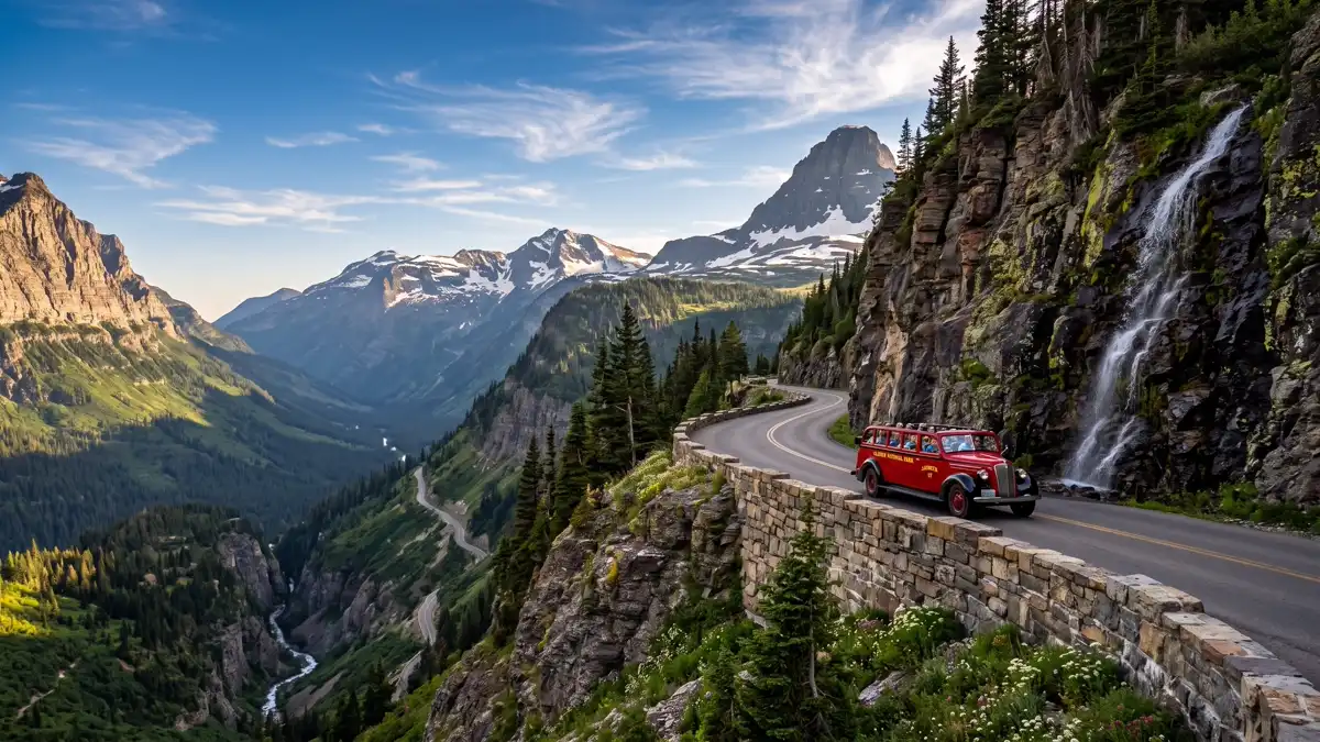
One of the greatest drives on Earth. This 50-mile alpine highway crosses the Continental Divide at Logan Pass (6,646 feet), threading through mountain tunnels, past cascading waterfalls, and along cliff faces where engineers carved the road into sheer rock without excessive blasting. Key stops include Lake McDonald's coloured rocks, the Trail of the Cedars boardwalk, the Weeping Wall (where groundwater seeps through rock and rains onto the road), Bird Woman Falls (500 feet), and the Wild Goose Island viewpoint. Allow 6-8 hours with stops. A 21-foot vehicle length restriction applies in the middle section.
The spine of the park — every visitor's experience revolves around this road. Open mid-June to mid-October.
Early morning (before 7 AM) to avoid traffic and parking issues. In 2026, vehicle reservations are required 7 AM-3 PM from June 13 through September 28.
Restroom facilities nearby — see map above
2Hidden Lake Overlook from Logan Pass
Iconic SightModerate — 2.7 miles to overlook (1.5 hrs), 5.3 miles to lakeshore (3 hrs)
Hidden Lake Overlook from Logan Pass
Iconic SightModerate — 2.7 miles to overlook (1.5 hrs), 5.3 miles to lakeshore (3 hrs)
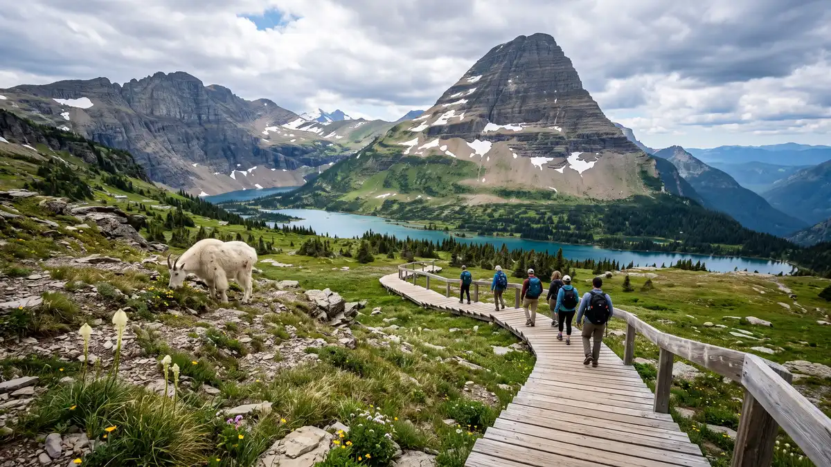
The crown jewel viewpoint of Glacier. From the Logan Pass visitor centre, a 2.7-mile round trip trail climbs through alpine wildflower meadows to a viewpoint above Hidden Lake, with Bearhat Mountain rising behind. Mountain goats graze right beside the trail — they're so accustomed to hikers that they barely move. In peak wildflower season (late June through early August), the meadows explode with beargrass, Indian paintbrush, glacier lilies, and arnica. Continue another 1.3 miles down to the lakeshore for a less crowded experience — most visitors stop at the overlook.
The most accessible alpine experience in the park. Mountain goats, wildflowers, and a panorama that earns its place on every 'best of' list.
Before 8 AM — Logan Pass parking fills by this time in summer. The 2026 season introduces a 3-hour parking limit.
Restroom facilities nearby — see map above
3Grinnell Glacier
Once-in-a-Lifetime HikeStrenuous — 10.6 miles round trip, 1,600 ft elevation gain (final 3.5 miles are relentless)
Grinnell Glacier
Once-in-a-Lifetime HikeStrenuous — 10.6 miles round trip, 1,600 ft elevation gain (final 3.5 miles are relentless)
This is the hike that makes people cry. A 10.6-mile round trip trail from Many Glacier passes through a progression of turquoise lakes, each a different shade of blue-green, through wildflower meadows, past thundering waterfalls, and finally to the glacier itself — a wall of ancient ice with turquoise meltwater and actual icebergs floating in the lake below. The glacier has lost 44.6% of its area since 1966. Scientists estimate it and the park's remaining glaciers could be gone within 15 years. A boat shuttle across Swiftcurrent and Josephine Lakes cuts 3.5 miles off the hike.
A now-or-never experience. One of the last remaining named glaciers in the US lower 48, and the trail to reach it is among the best day hikes in the country.
Late July through mid-September when the trail is snow-free. Start by 7 AM — Many Glacier parking fills by 7:30 AM in peak season.
Restroom facilities nearby — see map above
4Highline Trail & the Garden Wall
Signature HikeStrenuous — 7.6-11.8 miles, significant exposure. Not suitable for those with a fear of heights.
Highline Trail & the Garden Wall
Signature HikeStrenuous — 7.6-11.8 miles, significant exposure. Not suitable for those with a fear of heights.
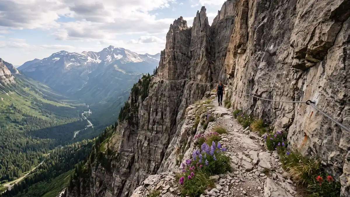
Widely considered the finest maintained trail in any US national park. Starting from Logan Pass, the trail immediately hits you with a narrow, exposed cliff-face traverse where a steel cable is bolted into the rock for hikers to grip — the Going-to-the-Sun Road sits hundreds of feet directly below. From there, the trail hugs the Continental Divide along the Garden Wall, with a 4,000-foot drop to the valley floor visible the entire way. The first four miles are rich with wildflowers. During super bloom years (every 5-7 years), the Garden Wall turns white with thousands of beargrass plumes mixed with scarlet Indian paintbrush. Can be done as a 7.6-mile out-and-back or an 11.8-mile point-to-point to Granite Park Chalet.
The quintessential Glacier hike — exposure, Continental Divide views, and wildflowers in one unforgettable package.
Mid-July through August for wildflowers. Start early — the trail gets afternoon sun exposure with no shade.
Restroom facilities nearby — see map above
5Many Glacier Valley
Essential AreaVaries — from lakeside strolls to strenuous all-day hikes
Many Glacier Valley
Essential AreaVaries — from lakeside strolls to strenuous all-day hikes
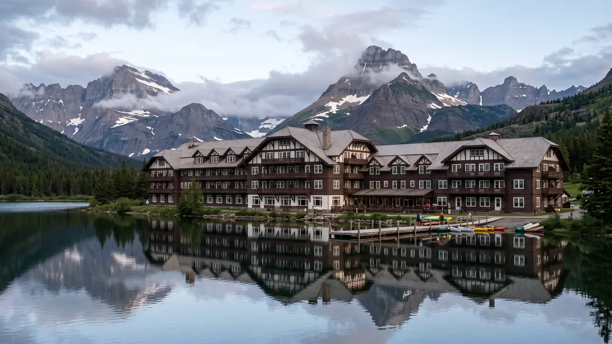
The park's hiking and wildlife capital. Swiftcurrent Lake reflects dramatic peaks at dawn, four world-class trailheads depart from the valley, boat tours cross the lakes ($35/adult), and the historic Many Glacier Hotel (built 1915 in Swiss chalet style) presides over it all. Grizzly bears and moose are frequently spotted in the surrounding meadows and avalanche chutes. Seasoned Glacier visitors say Many Glacier is so compelling that many plan return trips solely around this valley — 'it's that special.'
If you visit one area beyond the Sun Road, this is it. Best sunrise in the park from the hotel porch, best wildlife viewing, and three of the park's top hikes start here.
Sunrise for reflections on Swiftcurrent Lake. Arrive by 7 AM for parking.
Restroom facilities nearby — see map above
6Lake McDonald
Iconic SightEasy — accessible from multiple points along Going-to-the-Sun Road
Lake McDonald
Iconic SightEasy — accessible from multiple points along Going-to-the-Sun Road
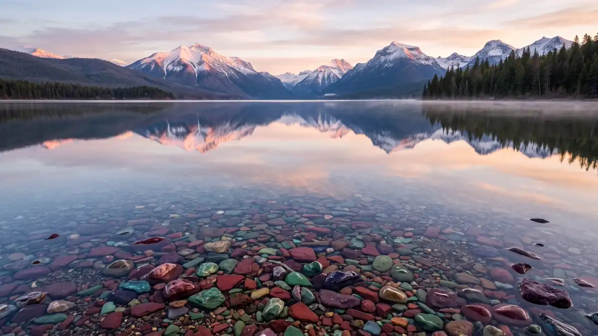
The park's largest lake — 10 miles long and 472 feet deep — is famous for its multicoloured rocks visible through crystal-clear water. Red, green, blue, and purple stones cover the lakebed, made of billion-year-old argillite and quartzite. Lake McDonald Lodge (1913, National Register of Historic Places) sits on the shore. The best sunset in Glacier happens at Apgar Village beach, where mountains glow with alpenglow after the sun drops below the horizon.
The park's most iconic and accessible photo location. Sunrise reflections and coloured rocks through clear water are world-class.
Dawn for still-water reflections. Sunset from Apgar Village beach for alpenglow.
Restroom facilities nearby — see map above
7Avalanche Lake
Family-Friendly HikeModerate — 5.9 miles round trip, 757 ft gain
Avalanche Lake
Family-Friendly HikeModerate — 5.9 miles round trip, 757 ft gain
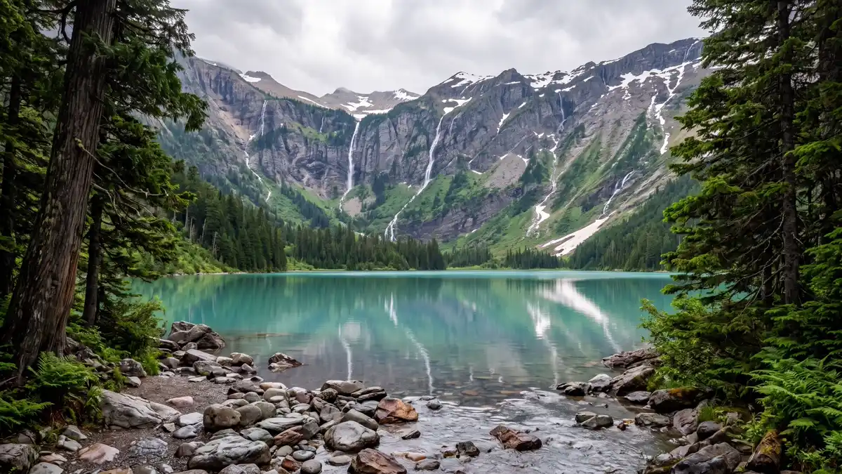
The best short hike for families in Glacier. A 5.9-mile round trip trail starts at the Trail of the Cedars — a wheelchair-accessible boardwalk through ancient red cedars that feel more Pacific Northwest than Montana. Beyond the boardwalk, the trail follows Avalanche Creek's turquoise water up to the lake, where cliff walls rise on three sides with multiple waterfalls streaming down from Sperry Glacier above.
Turquoise water, waterfalls, old-growth forest, and manageable distance. The single best introduction to Glacier for first-time visitors.
Before 8 AM or after 5 PM to avoid crowds. Early season (June) for peak waterfall flow.
Restroom facilities nearby — see map above
8Iceberg Lake
Signature HikeModerate to strenuous — 9.7 miles round trip, 1,275 ft gain
Iceberg Lake
Signature HikeModerate to strenuous — 9.7 miles round trip, 1,275 ft gain
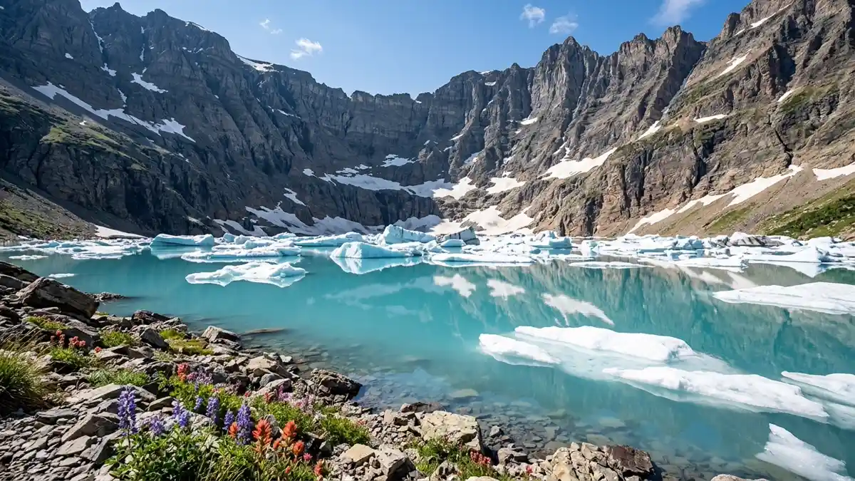
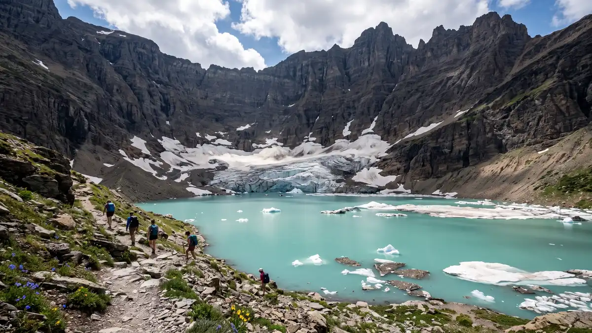
The name delivers. At the end of a 9.7-mile round trip trail from Many Glacier, you arrive at a cirque lake surrounded by 3,000-foot walls where actual icebergs float in turquoise water — even in summer. Pass Ptarmigan Falls halfway and walk through wildflower meadows with constant mountain views. This is the easiest of the three classic Many Glacier hikes, and many hikers consider it the most visually stunning.
Actual icebergs in a mountain lake. The wow factor is enormous.
Late July through early August for maximum iceberg and wildflower overlap.
Restroom facilities nearby — see map above
9Ptarmigan Tunnel
Unique ExperienceStrenuous — 10.6 miles round trip, 2,300 ft gain
Ptarmigan Tunnel
Unique ExperienceStrenuous — 10.6 miles round trip, 2,300 ft gain
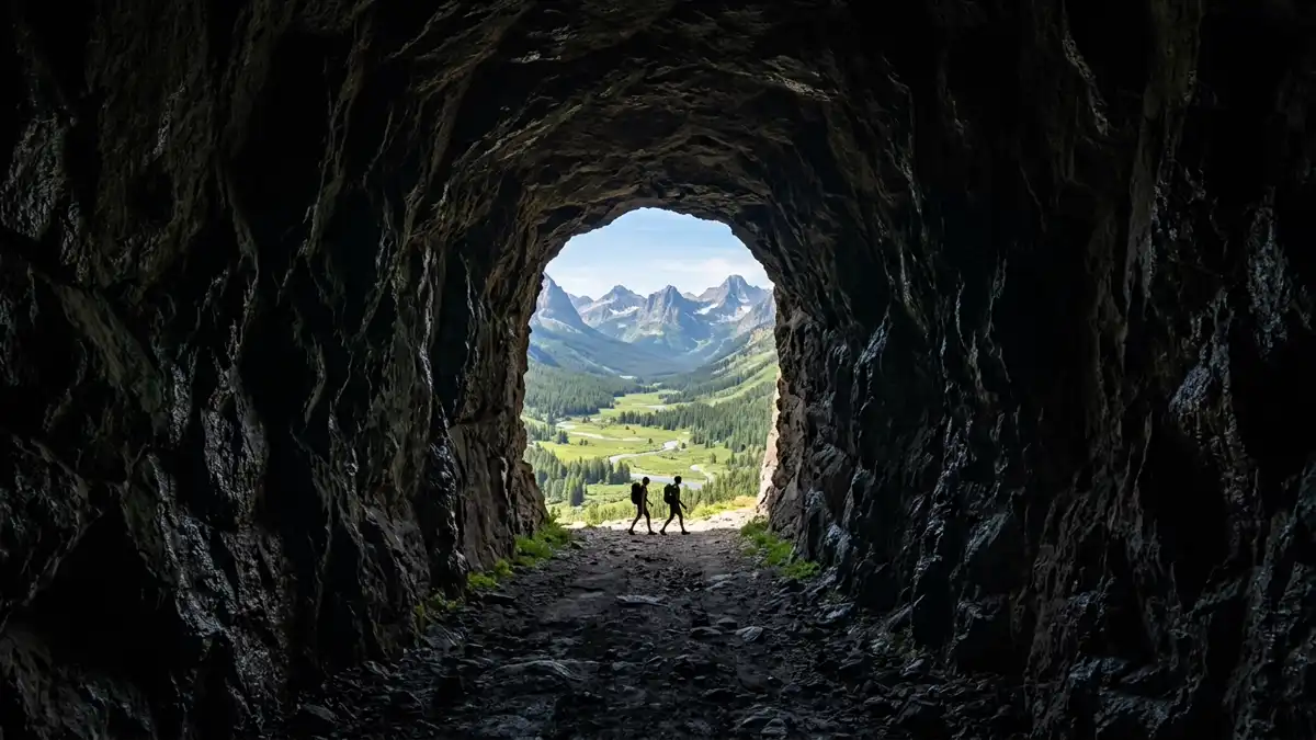
There is nothing like this in any other national park. A 10.6-mile round trip hike from Many Glacier climbs 2,300 feet to reach a 250-foot tunnel blasted through the Ptarmigan Wall in 1930 by the Civilian Conservation Corps. You walk into darkness and emerge into a completely different landscape on the other side — the Belly River valley stretching north toward Canada. The sense of stepping through a portal is genuinely thrilling.
A portal through a mountain wall. Takes 7-8 hours but delivers an experience that exists nowhere else.
Opens mid-July when snow clears. Best August through mid-September.
10Two Medicine Valley
Hidden GemVaries — from short waterfall walks to strenuous multi-day loops
Two Medicine Valley
Hidden GemVaries — from short waterfall walks to strenuous multi-day loops
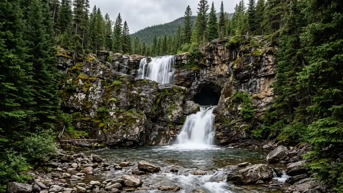
The criminally underrated section of Glacier. This remote southeastern valley sees far fewer visitors than Many Glacier or the Sun Road, but offers world-class hiking, one of the park's best campgrounds, and boat tours ($23/adult) on Two Medicine Lake. Running Eagle Falls (0.6 miles, wheelchair accessible) is an unusual 'trick falls' — in high water the falls cascade over the cliff top, but as flow decreases, water emerges from a cave partway down the cliff face, creating two waterfalls from different exits. The Pitamakan-Dawson Loop (19.2 miles) crosses two alpine passes and ranks among the park's best backcountry routes.
What Glacier felt like before the crowds. Real wilderness solitude with first-rate trails.
July through September. Far less crowded than other areas even in peak season.
Restroom facilities nearby — see map above
11Polebridge Mercantile & the North Fork
Hidden GemEasy — 90-minute drive on rough dirt road from Columbia Falls
Polebridge Mercantile & the North Fork
Hidden GemEasy — 90-minute drive on rough dirt road from Columbia Falls
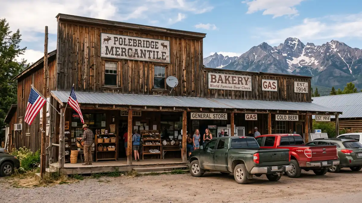
A 1914 general store powered entirely by solar, with no cell service and no petrol station. The mercantile is famous throughout Montana for its huckleberry bearclaws, baked in century-old ovens. Polebridge is the gateway to Bowman Lake and Kintla Lake — the park's most remote accessible waters. In autumn (late September through early October), golden larch trees line the North Fork Road, elk bugle in the meadows, and you may not see another vehicle for an hour.
The soul of Glacier. Fill your tank in Columbia Falls before heading north — there's nothing up here but wilderness and pastry.
Late September for golden larches and autumn solitude. Summer for lake access.
12Sperry Chalet
Once-in-a-LifetimeStrenuous — 6.3 miles, 3,400 ft gain to reach. Worth every step.
Sperry Chalet
Once-in-a-LifetimeStrenuous — 6.3 miles, 3,400 ft gain to reach. Worth every step.
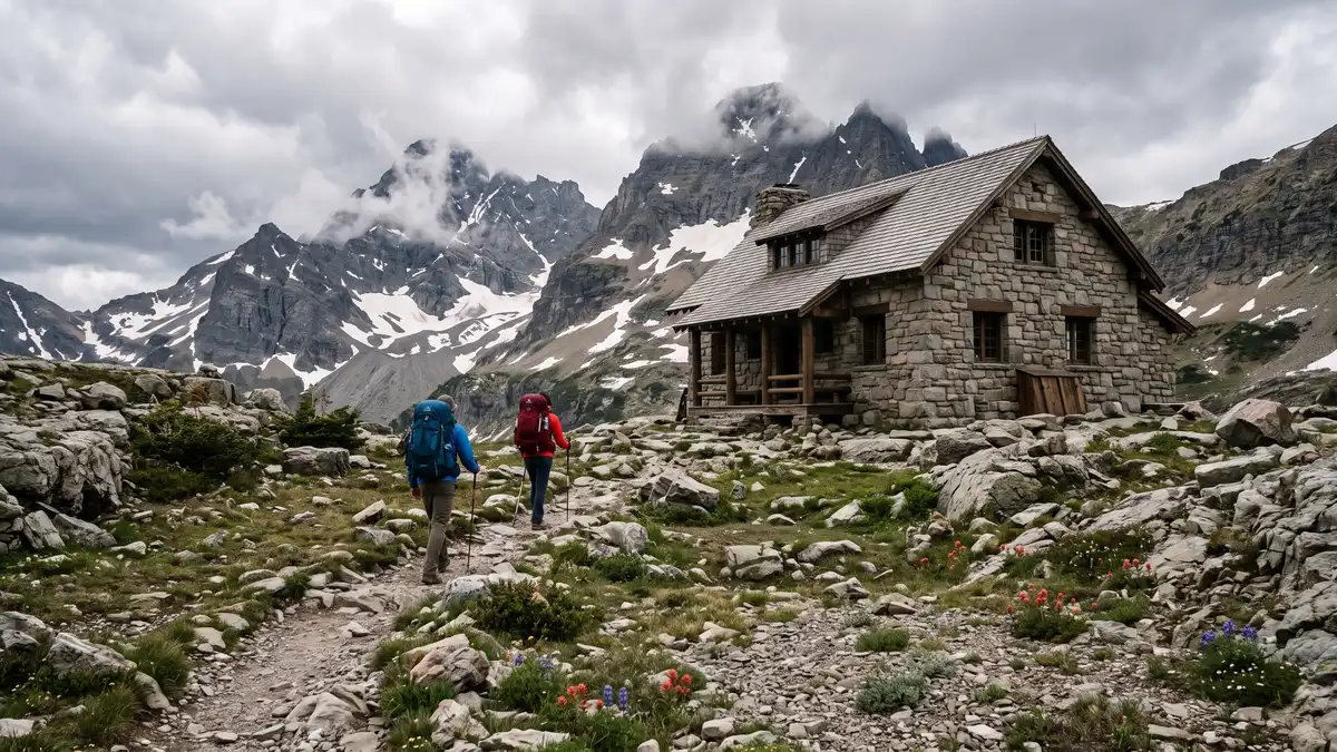
A stone chalet built in 1914 by the Great Northern Railway, destroyed by the 2017 Sprague Fire, and rebuilt by 2020. Reaching it requires a 6.3-mile hike gaining 3,400 feet. There's no electricity, no running water, and no road access. Dinner is prime rib. A night at Sperry costs $533 for two people, meals included. The staff greet you with cold lemonade after the climb. At season's end, all human waste from the facility is placed in barrels and helicoptered out. That's the level of wilderness commitment here.
Sleep in a mountaintop stone building surrounded by glaciers and stars. The closest thing to a European alpine hut in America.
Season runs July 10 through September 12. Reservations sell out within hours of opening — set an alarm.
Restroom facilities nearby — see map above
Things to Do at Glacier
Glacier offers experiences that go well beyond hiking — from 1930s vintage bus tours to Blackfeet cultural programs, from whitewater rafting the park's southern boundary to swimming among icebergs at Grinnell Glacier.
Wildlife Viewing
Grizzly Bears
Glacier has one of the largest grizzly bear populations in the lower 48. Many Glacier valley and the Highline Trail are prime viewing areas, particularly avalanche chutes where bears forage for berries in late summer. Always carry bear spray ($8-10 to rent, or borrow free from the Sharing Shack in Columbia Falls). Make noise on trails. A recent mauling on the Grinnell Glacier Trail (May 2026) is a reminder that these are genuinely wild animals.
Mountain Goats
White mountain goats are the park's most reliable wildlife sighting. They frequent Hidden Lake Trail, the Highline Trail, and Sperry Chalet area. They're habituated enough to graze within metres of hikers, but bighorn sheep (also common) have been known to charge — keep your distance.
Moose, Elk & More
Moose are common in the Many Glacier and Two Medicine valleys, particularly near water. Elk are best spotted during autumn rut (September-October) when bulls bugle in the meadows. The park also supports wolverines, mountain lions, lynx, and over 260 bird species.
Boat Tours
Many Glacier Boat Tour & Hike Combo
Board the historic Chief Two Guns vessel across Swiftcurrent Lake (25 minutes), walk a quarter-mile portage, then board the Morning Eagle (built 1945) across Lake Josephine. The colour difference between the two lakes is striking — Swiftcurrent is deep dark green, Josephine is aquamarine. This shortcut cuts 3.5 miles off the Grinnell Glacier hike, letting you focus energy on the final climb. $35/adult.
Two Medicine & St. Mary Boats
Boat tours also operate on Two Medicine Lake ($23/adult) and St. Mary Lake ($42/adult). The St. Mary tour passes directly beneath the Wild Goose Island viewpoint — a different perspective of the park's most photographed scene.
Cultural Heritage
Blackfeet Cultural Tours (Sun Tours)
See the park through Blackfeet eyes. Sun Tours is independently owned by enrolled Blackfeet and Assiniboine Sioux guides who share the Blackfoot spiritual and philosophical perspectives of the landscape. They cover plants used for nutrition and medicine, animal species, tribal history, and geological features alongside their cultural significance. Tour stops include Triple Divide, Wild Goose Island, Jackson Glacier, Heavy Runner Mountain, Logan Pass, and Bird Woman Falls.
Native America Speaks
The longest-running Indigenous speaker series in the National Park Service, started in 1982. Each summer evening, Blackfeet and CSKT (Confederated Salish and Kootenai Tribes) tribal members share personal knowledge of their history and culture. Free, open to all, held at multiple locations.
North American Indian Days
Held annually in July in Browning (just east of the park), this is one of the largest gatherings of North American tribes. Traditional dancing, drumming, rodeos, and cultural exchange. The Museum of the Plains Indian in Browning displays arts from Northern Plains tribes year-round.
Stargazing
International Dark Sky Park
Glacier is one of only 26 International Dark Sky Parks worldwide — and the first transboundary dark sky park (shared with Canada's Waterton Lakes). 80% of Americans cannot see dark skies like this at home. The Milky Way is visible to the naked eye. Northern lights have been seen from Lake McDonald as late as September. Best locations: Apgar Village, Logan Pass, Lake McDonald shore.
Ranger-Led Star Programs
Free ranger-led astronomy programs run throughout summer at multiple locations. These combine telescopes with expert guidance on constellations, planets, and deep-sky objects. The park's night sky camera at Dusty Star Observatory captures time-lapse footage.
Adventure Activities
Whitewater Rafting (Middle Fork Flathead)
The Middle Fork of the Flathead River forms the park's southern boundary. Half-day trips cover 9 miles and 10 named rapids through John F. Stevens Canyon — you're rafting through Glacier without the hiking crowds. Scenic float trips available for families with children as young as 3.
Red Bus Tours
Glacier's fleet of original 1930s touring buses — not reproductions — with roll-back canvas tops. These are among the oldest touring vehicles still in service in the world. Tours depart from multiple locations on the east and west sides of the park.
Winter Snowshoeing & Skiing
Free ranger-led 2-hour snowshoe tours run on weekends from December through March. Cross-country ski or snowshoe the unplowed Going-to-the-Sun Road. The Apgar area stays open year-round. 90%+ of visitors come in summer — winter Glacier is a different, silent world.
All 51 Restrooms in Glacier National Park
Every mapped restroom in Glacier, grouped by location type.
Park Facilities(38)
ADA-Accessible Restrooms in Glacier National Park
12 wheelchair-accessible restrooms confirmed across Glacier National Park. Each facility below meets ADA accessibility standards — wider stalls, grab bars, and level access. Download the GPX file to save these locations to your GPS before entering the park.
Campground Restrooms, Showers & Water in Glacier
13 campgrounds with restroom and utility details.
Tap any campground name to fly to it on the map above.
| Campground | Restrooms | Showers | Water | Dump Station |
|---|---|---|---|---|
| Flush Toilets - seasonal | Free - Seasonal | Yes - seasonal | Yes - seasonal | |
| Flush Toilets - seasonal | No | Yes - seasonal | No | |
| Vault Toilets - seasonal | No | Yes - seasonal | Yes - seasonal | |
| Vault Toilets - seasonal | No | No water | No | |
| Flush Toilets - seasonal | Hot - Seasonal | Yes - seasonal | Yes - seasonal | |
| Vault Toilets - seasonal | No | Yes - seasonal | Yes - seasonal | |
| Vault Toilets - seasonal | No | No water | No | |
| Flush Toilets - seasonal | No | Yes - seasonal | Yes - seasonal | |
| Vault Toilets - seasonal | No | No water | No | |
| Flush Toilets - seasonal | Coin-Operated - Seasonal | Yes - seasonal | Yes - seasonal | |
| Flush Toilets - seasonal | No | Yes - seasonal | No | |
| Flush Toilets - seasonal | Hot - Seasonal | Yes - seasonal | Yes - seasonal | |
| Flush Toilets - seasonal | No | Yes - seasonal | Yes - seasonal |
Trailhead Restrooms & Hiking Facilities in Glacier
16 trailheads with restrooms. Plan accordingly — most trails have no facilities beyond the trailhead.
Once you leave the trailhead, there are typically no restroom facilities on the trail itself. Plan your stops before heading out.
St. Mary Falls Trailhead
Running Eagle Falls Trailhead
Hidden Lake Trailhead
Highline Trailhead
Rocky Point Trailhead
Numa Lookout Trailhead
Rainbow Falls Trailhead
Paradise Point Trail
Otokomi Lake Trailhead
Redrock Falls Trail
Swiftcurrent Lake Trail
Iceberg Lake Trailhead
Grinnell Glacier Trailhead
Beaver Pond Loop Trailhead
Trail of the Cedars
Avalanche Lake Trail
Hiking Trails (2)
| Trail | Distance | Difficulty | Type | Season | Trailhead Restroom |
|---|---|---|---|---|---|
Take a Half-Day Hike in Glacier | — | — | SpringSummerFall | ✗ | |
Take a Full Day Hike in Glacier | — | — | SpringSummerFall | ✗ |
Sorted by distance (shortest first). Check the trailhead for current restroom availability.
Visitor Centers with Restrooms in Glacier
3 visitor centers — all with ADA-compliant restrooms.
All visitor centers have ADA-compliant restrooms with running water.
Apgar Visitor Center is located 2 miles east of the West Glacier entrance to the park. Rangers are on duty to assist with trip planning. The visitor center is the hub for the Going-to-the-Sun Road shuttle system on the west side of the park.
The Apgar Visitor Center is open seven days a week in the summer. In the winters the Apgar Visitor Center is sometimes open on weekends.
The Logan Pass Visitor Center sits atop the Continental Divide at 6,646 feet. The visitor center houses exhibits on the plants and animals found in the sub-alpine region of the park. Numerous exhibits outside the visitor center tell the story of geology, climate change, and life in the harsh alpine
The Logan Pass Visitor Center typically opens in late June to early July.
The St. Mary Visitor Center is located just inside the east entrance of the park near the community of St. Mary, Montana. Rangers are on duty inside to assist with trip planning. A park film is shown throughout the day. Exhibits highlight the rich Native American history associated with Glacier Nati
The St. Mary Visitor Center is open seven days a week in the summer.
Glacier Entry Fees & Park Hours
Ranger Programs & Events in Glacier
20 upcoming programs including guided walks, talks, and evening campfire programs. Most take place at visitor centers which all have restroom facilities.
+ 16 more programs available
Self-Guided Tours in Glacier with Restroom Stops
7 self-guided walking and driving tours through Glacier. Each tour lists the number of stops — if we know a stop has restroom access, we flag it so you can plan your route without surprises.
Climate & History: A short walking tour at Logan Pass
This is a short walking tour of six exhibits at Logan Pass. Each exhibit uses an historic black and white picture to illustrate a different aspect of Glacier's changing climate. All of the exhibits ar...
Folds, Faults, and Formations: A Drivable Geology Tour in St. Mary Valley
The rainbow of rocks that make up Glacier’s mountains aren’t just beautiful, they tell the history of their formation. This self-guided driving tour takes you to five points on the east side of the pa...
Forest and Fire Nature Trail: A Hiking Tour in the North Fork
Welcome to the Forest and Fire Nature Trail guided tour. This tour combines a series of exhibits about wildfire at the parking area and trailhead with a short hike that offers the chance to see the ef...
Going-to-the-Sun Road Tour
A self-guided audio tour of Going-to-the-Sun Road.
Many Glacier Hotel History Audio Tour
This is a short walking tour to three locations in and around the Many Glacier Hotel. The hotel represents the challenge of bringing a vision to life and sustaining it into the future—a challenge face...
Running Eagle Falls Nature Trail: Accessible Family-Friendly Walking Tour in Two Medicine
In this accessible and family-friendly short walking tour, explore native plants and their traditional uses along this trail. People have lived in this area for centuries, long before it became a park...
Wildlife Superpowers: Family-Friendly Walking Tour at Logan Pass
In this family-friendly short walking tour, learn about the subalpine ecosystem of Logan Pass that is home to creatures with amazing abilities. They require special adaptations to survive at this elev...
Explore More National Park Restroom Guides
Every park mapped with restrooms, trails, and downloadable GPX files — plan before you lose signal.
The Blackfeet & the Backbone of the World
The Backbone of the World
The Blackfeet (Niitsitapi) call these mountains the Backbone of the World. Their ancestral territory stretched from present-day Alberta to the Yellowstone River — nearly 28 million acres. Sacred locations including Chief Mountain, Two Medicine, and Many Glacier hold spiritual significance tied to creation narratives, vision quests, and ceremonial practices that continue today. The mountains weren't a backdrop to their culture — they were the centre of it.
The 1895 Land Sale
Under intense US government pressure, the Blackfeet were forced to sell the mountain strip that became Glacier's eastern half. They were promised continued access for hunting, fishing, ceremonies, and vision quests. Those rights were subsequently restricted or eliminated. That history is still present today — the Blackfeet Reservation borders the park's entire eastern boundary, and the tribe continues to advocate for recognition of their cultural rights and connection to this landscape.
The Great Northern Railway Era
Glacier's development as a tourist destination was driven by the Great Northern Railway, which built the park's iconic lodges and chalets in the 1910s to attract passengers to its transcontinental line. The Swiss chalet architectural style was deliberately chosen to market Glacier as 'America's Switzerland.' Many of these structures — including Many Glacier Hotel, Lake McDonald Lodge, Sperry Chalet, and Granite Park Chalet — remain standing and are listed on the National Register of Historic Places.
The Disappearing Glaciers
When the park was established in 1910, it contained an estimated 150 glaciers. Today, 25 named glaciers remain, and they're shrinking fast. Grinnell Glacier has lost 44.6% of its area since 1966. Jackson Glacier, visible from a roadside overlook on Going-to-the-Sun Road, has split into multiple fragments. USGS scientists estimate that under current climate trajectories, most of the park's remaining glaciers could disappear within the next 10-15 years. This isn't abstract science — it's visible in a single human lifetime. Photographs from the 1900s compared with today show bare rock where ice once covered mountainsides. The park removed its signs predicting glaciers would be 'gone by 2020' after the timeline proved uncertain, but the trajectory hasn't changed.
When to Visit Glacier
Mid-June – Early July
Going-to-the-Sun Road typically opens mid-June after the Big Drift — a one-mile stretch east of Logan Pass that accumulates 50-80 feet of snow each winter — is plowed. Waterfalls are at peak flow from snowmelt. Wildflowers begin at lower elevations. High-country trails may still have snow. Crowds building but not yet peak.
Mid-July – Mid-August
The optimal window. All trails open, wildflowers at peak, warmest temperatures (70s-80s°F at lake level, 40s-60s°F at Logan Pass — the temperature can differ by 40°F). Parking lots fill by 7-8 AM. Vehicle reservations required for GTTSR 7 AM-3 PM.
September
Crowds thin dramatically after Labour Day. Larches begin turning gold in the North Fork area (late September). Elk bugling in meadows. Some facilities start closing mid-month. Northern lights possible. Autumn light is extraordinary for photography.
October – May
Going-to-the-Sun Road closes. Most park services shut down. Apgar area and the road to Lake McDonald Lodge stay open. Free ranger-led snowshoe tours on weekends December through March. A completely different Glacier — silent, snow-covered, and yours.
Essential Tips
Bear Spray
Mandatory for backcountry hiking. Purchase at park entrance stations ($8-12 rental, ~$50 purchase) or borrow free from the Sharing Shack in Columbia Falls. Cannot be brought on aeroplanes. Practice deploying it before you need it.
Layer for Elevation
It can be 90°F at Lake McDonald (3,153 ft) and 45°F at Logan Pass (6,646 ft) on the same day. Bring layers regardless of the forecast. Wind chill on exposed ridges adds another factor.
Parking Reality
Logan Pass: fills by 8 AM. Many Glacier: fills by 7:30 AM. Avalanche Creek: fills by 9 AM. Enter the Sun Road before 6 AM or after 5 PM to avoid the 2026 vehicle reservation requirement.
Cell Service
Spotty at best. Some signal at West Glacier, St. Mary, and parts of Going-to-the-Sun Road. No service in Many Glacier, Two Medicine, or the North Fork. Download offline maps before entering.
Lodging Strategy
Where you sleep decides which half of the park you see. West side (West Glacier, Apgar): best for GTTSR, Lake McDonald, Avalanche Lake. East side (St. Mary, Many Glacier): best for the iconic hikes. Book 13 months in advance — lodging sells out fast.
Live Webcams — Glacier Current Conditions
22 webcams showing current conditions in Glacier.
Glacier National Park Restroom FAQs
Are there restrooms in Glacier National Park?
Are restrooms in Glacier ADA accessible?
Does Glacier have showers?
Is there drinking water in Glacier?
What types of restrooms are in Glacier?
Are restrooms open in Glacier during winter?
Do campgrounds in Glacier have restrooms?
Do visitor centers in Glacier have restrooms?
Restrooms Near Glacier
Gateway towns with public restrooms just outside park entrances.
More National Park Restroom Guides
Park data provided by the National Park Service (public domain). Facility availability may change seasonally.