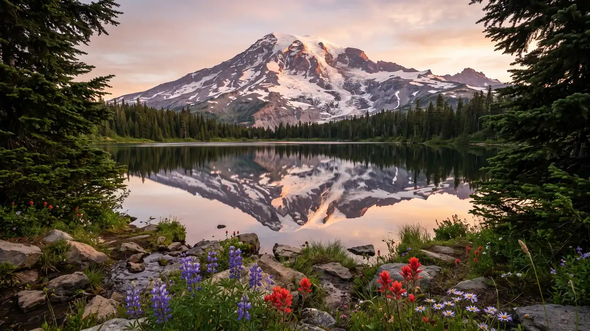
Restrooms in Mount Rainier National Park
Every restroom in Mount Rainier National Park mapped and downloadable — flush toilets, vault toilets, ADA-accessible facilities, and drinking water. Most of the park has zero cell reception. Download the free GPX file before you go and take the map offline.
Photo: DunnyDash
Current Mount Rainier Alerts & Closures
Be cautious around park rivers & learn how to cross safely!
Many hikers underestimate the power of moving water. Regardless of your knowledge, skills, and experience use these pointers in making wise decisions before attempting to cross a river.
Parkwide Fire Ban in effect until further notice beginning June 26
Beginning Friday 6/26/26 until rescinded, a parkwide fire ban is implemented for all campfires & the ignition of wood, briquettes, or any fuel in fire pits, fire pans, & BBQ grills.
Show 4 more alerts
Your GPS May Be Wrong
There are five entrances to the park. GPS may take you to the wrong entrance or attempt to follow the most direct route, which could lead to closed gates. It can take hours to reroute to the correct entrance. Check directions & maps, not just your GPS.
Expect long lines at entrances on weekends.
Lengthy delays are likely at the southwest park entrance on SR706 on weekends. Check Google Maps for backup (represented by the orange/red line) at link below. Please do not block driveways or roads while in line outside the park.
Ohanapecosh Campground area closed for construction in 2026.
The entire Ohanapecosh Campground area is CLOSED for the duration of the construction project, including all campsites, visitor center, restrooms, picnic area, & Ohanapecosh river access.
SR 165 Carbon River/Fairfax Bridge is closed: no access to Carbon River or Mowich Lake.
There is NO public access to Carbon River & Mowich Lake from SR 165. The bridge is closed to pedestrians, bicycles and vehicles and there is no alternate route.
About Mount Rainier National Park — Facilities & Access
2026 Edition — Updated July 2026Ascending to 14,410 feet above sea level, Mount Rainier stands as an icon in the Washington landscape. An active volcano, Mount Rainier is the most glaciated peak in the contiguous U.S.A., spawning five major rivers. Subalpine wildflower meadows ring the icy volcano while ancient forest cloaks Mount Rainier’s lower slopes. Wildlife abounds in the park’s ecosystems. A lifetime of discovery awaits.
Park Hours
Mount Rainier National Park is open all year. Visitation peaks in July and August with warmer weather and blooming wildflowers. In spring and autumn, weather determines the availability of facilities and roads. During winter months a number of roads, facilities, and entrances close for the season.
Seasonal Availability
31 restrooms are open year-round. 8 restrooms are seasonal (typically May–October).
Planning Tool — Not a Navigation Device
Trail data sourced from the National Park Service. This is a pre-trip planning tool — always carry a topographic map, check current conditions before departure, and register at the backcountry office for overnight trips. Do not rely solely on digital maps in areas without cell service. Facility availability changes seasonally.
Mount Rainier National Park Restroom & Trail Map
USGS topographic basemap with 39 restrooms and NPS trail data. Tap any marker for details. Click trail names below to highlight on the map.
Loading trail map...
Take This Map Offline
Your phone won't work past the entrance. Download the GPX file now, load it into Gaia GPS or AllTrails, and you'll have every restroom and trail pinned — no signal required.
GPX format — works with Gaia GPS, AllTrails, Garmin, and Apple Watch. No cell service needed.
How to use this map
- 1. Use the filter buttons to toggle restrooms, trailheads, campgrounds, and points of interest.
- 2. Click any trail or facility name below to fly to it on the map.
- 3. Tap any marker for details and one-tap Google Maps directions.
- 4. Download GPX files to use offline in Gaia GPS, AllTrails, or any GPS app.
- 5. Screenshot this map as a backup — most areas have no cell service.
Trail and facility data provided by the National Park Service (public domain). Topographic basemap by USGS. Map compilation, presentation, and GPX packaging by DunnyDash.com. Any reproduction or redistribution of these maps must attribute dunnydash.com as the source. Facility availability may change seasonally — verify current conditions before your visit.
All 39 Restrooms in Mount Rainier National Park
Every mapped restroom in Mount Rainier, grouped by location type.
Park Facilities(28)
ADA-Accessible Restrooms in Mount Rainier National Park
21 wheelchair-accessible restrooms confirmed across Mount Rainier National Park. Each facility below meets ADA accessibility standards — wider stalls, grab bars, and level access. Download the GPX file to save these locations to your GPS before entering the park.
Campground Restrooms, Showers & Water in Mount Rainier
3 campgrounds with restroom and utility details.
Tap any campground name to fly to it on the map above.
| Campground | Restrooms | Showers | Water | Dump Station |
|---|---|---|---|---|
| Flush Toilets - seasonal | No | Yes - seasonal | No | |
| Flush Toilets - seasonal | No | Yes - seasonal | No | |
| Flush Toilets - seasonal | No | Yes - seasonal | No |
Trailhead Restrooms & Hiking Facilities in Mount Rainier
11 trailheads with restrooms. Plan accordingly — most trails have no facilities beyond the trailhead.
Once you leave the trailhead, there are typically no restroom facilities on the trail itself. Plan your stops before heading out.
Silver Falls Trailhead
Green Lake Trailhead
Grove of the Patriarchs Trailhead
Glacier Basin Trailhead
Chenuis Falls Trailhead
Old Mine Trailhead
Paradise Meadows & Skyline Trailhead
Sunrise Nature Trail Stop 1
Mowich Lake Entrance & Paul Peak Trailhead
Sourdough Ridge Trailhead at Sunrise
Wonderland Trail: Longmire Trailhead
Hiking Trails (21)
| Trail | Distance | Difficulty | Type | Season | Trailhead Restroom |
|---|---|---|---|---|---|
Hike to Silver Falls | — | — | SpringSummerFall | ✓ | |
Day Hiking at Mount Rainier National Park | — | Easy | — | SpringSummerFall | ✗ |
Cloudy Day Activities at Mount Rainier | — | — | WinterSpringSummerFall | ✗ | |
A Day In Longmire | — | — | WinterSpringSummerFall | ✓ | |
Spring Recreation | — | — | Spring | ✗ | |
Kid-Friendly Hikes at Mount Rainier | — | — | Summer | ✗ | |
Mount Rainier: Off the Beaten Path | — | — | SpringSummerFall | ✗ | |
Hike to Spray Falls | — | — | Summer | ✗ | |
Hike to Shriner Peak Fire Lookout | — | — | SpringSummerFall | ✗ | |
Hike Rampart Ridge | — | — | WinterSpringSummerFall | ✗ | |
Hike to Gobblers Knob Fire Lookout | — | — | SpringSummerFall | ✗ | |
Hike to Bench and Snow Lakes | — | — | SummerFall | ✗ | |
Hike to Burroughs Mountain | — | — | Summer | ✗ | |
Hike Emmons Moraine Trail | — | — | SummerFall | ✗ | |
Explore Tipsoo Lake | — | — | Summer | ✗ | |
Hike Nisqually Vista Trail | — | — | WinterSpringSummerFall | ✗ | |
A Half-Day in Paradise | — | Easy | — | Summer | ✓ |
Family-Friendly Paradise Activities | — | — | SummerFall | ✓ | |
Ohanapecosh Area Activities | — | — | SummerFall | ✗ | |
A Day In Sunrise | — | — | Summer | ✓ | |
A Day In Paradise | — | — | SpringSummerFall | ✓ |
Sorted by distance (shortest first). Check the trailhead for current restroom availability.
Visitor Centers with Restrooms in Mount Rainier
8 visitor centers — all with ADA-compliant restrooms.
All visitor centers have ADA-compliant restrooms with running water.
Located in the northwest corner of the park, the ranger station is staffed by rangers or volunteers. Building hours may vary so call ahead for hours 360-829-9639. When open, rangers and volunteers provide park information, wilderness camping, and climbing permits. Wilderness camping permits availabl
Until further notice, there is NO access to Carbon River & Mowich Lake due to the closure of the SR165 Carbon River Fairfax Bridge outside of the park. The bridge is closed to pedestrians, bicyclists,
Located at Paradise, on the south side of Mount Rainier, the Jackson Visitor Center is open throughout the summer and with limited days and hours in the winter. Inside the visitor center are accessible restrooms, an information desk staffed by a ranger or volunteer, food services, gift shop, park mo
Days and hours of operation vary greatly according to season. During the summer, late spring, and early fall, the center is generally open daily with extended hours at the height of summer. The rest o
Located on the south side of Mount Rainier at 2,700 feet above sea level, the museum makes up part of the historic Longmire district. Once a ranger office, the building now houses historic exhibits about the park's natural and geological history, and animals. A ranger or volunteer staffs the museum
Generally open daily year-round, hours and days of operation may change suddenly due to weather or staffing demands. Closed midday from 12:00 pm - 1:00 pm.
Open during the summer, the Longmire Wilderness Information Center (WIC) is located in the lobby of the historic Longmire Administration Building, a picturesque example of National Park Service rustic architecture in Longmire. The WIC features a 3D model map of Mount Rainier National Park and has an
Generally open late May through mid-October. Hours and days of operation may change suddenly due to staffing demands.
NOTE: The Ohanapecosh Visitor Center is CLOSED for the summer of 2026 as part of the Ohanapecosh Campground rehabilitation project. This visitor center is located in the southeast corner of the park on State Route 123, 12 miles north of the town of Packwood. It is next to the Ohanapecosh Campground
Only open in the summer, this visitor center generally opens in late June and closes early September. Staffed by rangers and volunteers, days and hours of operation can vary and are posted on Ohanapec
Open during the summer, the Paradise Wilderness Information Center (WIC) is located in the main room of the historic Guide House. The WIC has an information desk staffed by wilderness rangers. Rangers at the WIC assist with wilderness permits, trip planning, and providing maps and trail condition up
Generally open daily late May through early September. Hours and days of operation may change suddenly due to weather or staffing demands.
Located on the northeast flank of Mount Rainier, this visitor center is at the end of the Sunrise Road, 15 miles after the turn off from State Route 410. Only open and accessible in summer, the Sunrise Visitor Center has exhibits, books and maps for sale, and rangers and volunteers on duty to answer
Only open in the summer, the first day for the Sunrise Visitor Center depends on weather and snow conditions. Typically, the visitor center opens around the beginning of July and closes in September.
Open during the summer, the White River Wilderness Information Center (WIC) located at the Winter River Entrance. The WIC has an information desk staffed by wilderness rangers. Rangers at the WIC assist with wilderness permits, trip planning, and providing maps and trail condition updates.
Located at the White River Entrance on the northeast area of the park. Services include wilderness camping and east side climbing permits, restrooms, and information on hiking & backpacking. Generally
Mount Rainier Entry Fees & Park Hours
Ranger Programs & Events in Mount Rainier
14 upcoming programs including guided walks, talks, and evening campfire programs. Most take place at visitor centers which all have restroom facilities.
+ 10 more programs available
Self-Guided Tours in Mount Rainier with Restroom Stops
10 self-guided walking and driving tours through Mount Rainier. Each tour lists the number of stops — if we know a stop has restroom access, we flag it so you can plan your route without surprises.
Glaciers of Mount Rainier
Mount Rainier is the most glaciated peak in the contiguous United States with 28 named glaciers, plus numerous unnamed snowfields. Learn more about the major glaciers in this virtual tour, starting in...
Historic Patrol Cabins and Shelters
Prior to 1920, there were very few shelters for backcountry rangers and hikers. In 1919-20, Superintendent Roger W. Toll reported the need for backcountry shelters to be placed ten to fifteen miles ap...
Journey to Paradise
Enter the Nisqually Entrance in the southwest corner of Mount Rainier National Park and begin the journey to Paradise. Drive along a historic winding road through old-growth forest with glimpses of Mo...
Longmire Historic District Walking Tour
This walking tour is an easy and approachable introduction to the historic structures of Mount Rainier National Park. At Mount Rainier, designers selected massive logs and glacial boulders as the buil...
Mount Rainier Waterfalls
This waterfall guide provides an overview of Mount Rainier's waterfalls that can be viewed from park roads or trails.
Nisqually Vista Nature Tour
Season: Summer The Nisqually Vista Nature Trail is open year-round and is a popular snowshoeing route in winter, but this self-guided tour is designed for the summer season when the trail is snow-free...
Paradise Historic District Walking Tour
Since the late 1890s Paradise has served as a base camp for people attracted to the spectacular wildflower meadows and high-mountain recreation. Built between 1916 and 1942, structures at Paradise wer...
Sunrise Geology Audio Tour
The road from White River to Sunrise is a journey through the geologic history of Mount Rainier. Volcanoes and glaciers have dramatically shaped the landscape. The first part of the tour is intended f...
Sunrise Nature Trail Walking Tour
Enjoy the sights and learn more about this landscape that has been shaped by volcanic activity. The meadows here are fragile, do your part by staying on the trail to protect these precious places. To...
Trail of the Shadows Walking Tour
The Trail of the Shadows is an easy, 0.7 mile-loop trail that weaves around the Longmire Meadow. Created by volcanic mineral springs, this unique low elevation meadow is home to a rich ecosystem of pl...
Explore More National Park Restroom Guides
Every park mapped with restrooms, trails, and downloadable GPX files — plan before you lose signal.
Mount Rainier National Park Restroom FAQs
Are there restrooms in Mount Rainier National Park?
Are restrooms in Mount Rainier ADA accessible?
Does Mount Rainier have showers?
Is there drinking water in Mount Rainier?
What types of restrooms are in Mount Rainier?
Are restrooms open in Mount Rainier during winter?
Do campgrounds in Mount Rainier have restrooms?
Do visitor centers in Mount Rainier have restrooms?
More National Park Restroom Guides
Park data provided by the National Park Service (public domain). Facility availability may change seasonally.