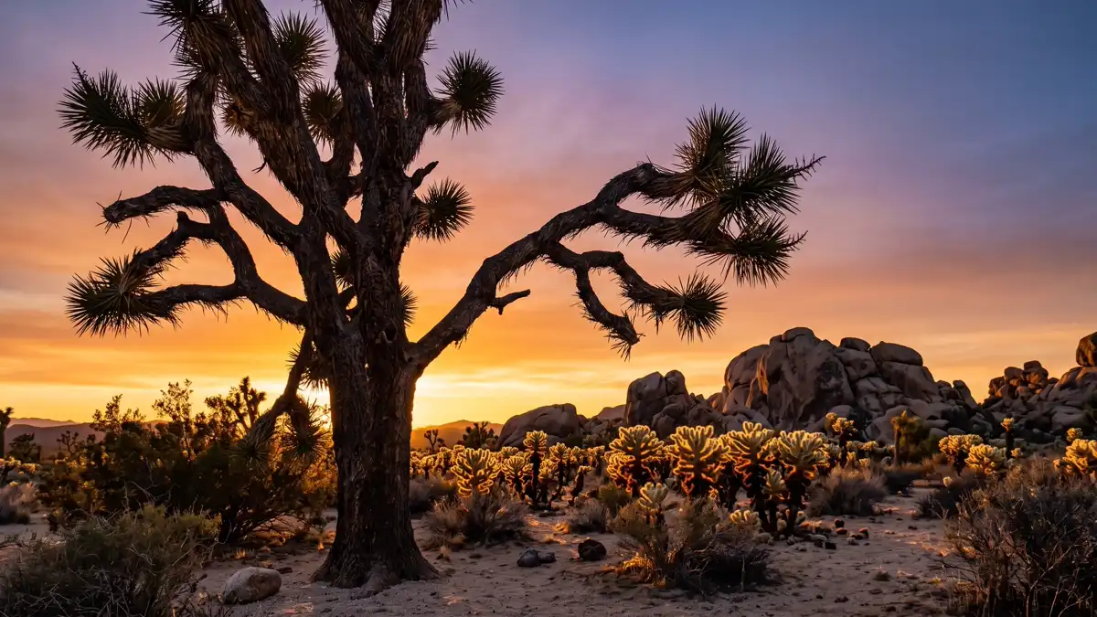
Restrooms in Joshua Tree National Park
Every restroom in Joshua Tree National Park mapped and downloadable — flush toilets, vault toilets, ADA-accessible facilities, and drinking water. Most of the park has zero cell reception. Download the free GPX file before you go and take the map offline.
Photo: DunnyDash
Current Joshua Tree Alerts & Closures
Annual Summer Closures and Restrictions in Effect
The 49 Palms trail along with some campgrounds, facilities, and areas have adjusted availability during the summer. For the full list of changes, please visit our Summer Closures page.
Oasis of Mara Trail Partial Closure
Due to a heavy flooding event, the Oasis of Mara Trail is closed past the Oasis.
Show 1 more alert
Inaccurate Third-Party Apps
Some third-party hiking apps are providing inaccurate trail and safety information to users. Please use the official NPS app for accurate information.
About Joshua Tree National Park — Facilities & Access
2026 Edition — Updated July 2026Two distinct desert ecosystems, the Mojave and the Colorado, come together in Joshua Tree National Park. A fascinating variety of plants and animals make their homes in a land sculpted by strong winds and occasional torrents of rain. Dark night skies, a rich cultural history, and surreal geologic features add to the wonder of this vast wilderness in southern California. Come explore for yourself!
Park Hours
Joshua Tree National Park is open 24 hours a day, 7 days a week, 365 days a year. Visitation increases as temperatures moderate in the fall, peaks during the spring wildflower season, and diminishes during the heat of summer. Some areas of the park are designated for day use only. Visitor centers keep separate hours; please see descriptions.
Seasonal Availability
58 restrooms are open year-round. All 58 restrooms are listed as year-round, though winter access may be limited by road closures.
Planning Tool — Not a Navigation Device
Trail data sourced from the National Park Service. This is a pre-trip planning tool — always carry a topographic map, check current conditions before departure, and register at the backcountry office for overnight trips. Do not rely solely on digital maps in areas without cell service. Facility availability changes seasonally.
Joshua Tree National Park Restroom & Trail Map
USGS topographic basemap with 58 restrooms and NPS trail data. Tap any marker for details. Click trail names below to highlight on the map.
Loading trail map...
Take This Map Offline
Your phone won't work past the entrance. Download the GPX file now, load it into Gaia GPS or AllTrails, and you'll have every restroom and trail pinned — no signal required.
GPX format — works with Gaia GPS, AllTrails, Garmin, and Apple Watch. No cell service needed.
How to use this map
- 1. Use the filter buttons to toggle restrooms, trailheads, campgrounds, and points of interest.
- 2. Click any trail or facility name below to fly to it on the map.
- 3. Tap any marker for details and one-tap Google Maps directions.
- 4. Download GPX files to use offline in Gaia GPS, AllTrails, or any GPS app.
- 5. Screenshot this map as a backup — most areas have no cell service.
Trail and facility data provided by the National Park Service (public domain). Topographic basemap by USGS. Map compilation, presentation, and GPX packaging by DunnyDash.com. Any reproduction or redistribution of these maps must attribute dunnydash.com as the source. Facility availability may change seasonally — verify current conditions before your visit.
Unmissable Sights at Joshua Tree
Joshua Tree spans two deserts — the higher Mojave in the north, dense with its namesake twisted trees, and the lower Colorado in the south, where ocotillo and cholla cactus take over. The transition zone between them, marked by the Cholla Cactus Garden, is one of the most photographed spots in all of California. Whether you're here for a half-day drive-through or a multi-day backcountry traverse, these are the sights that define the park.
1Cholla Cactus Garden
Iconic SightEasy — flat 0.25-mile boardwalk loop
Cholla Cactus Garden
Iconic SightEasy — flat 0.25-mile boardwalk loop
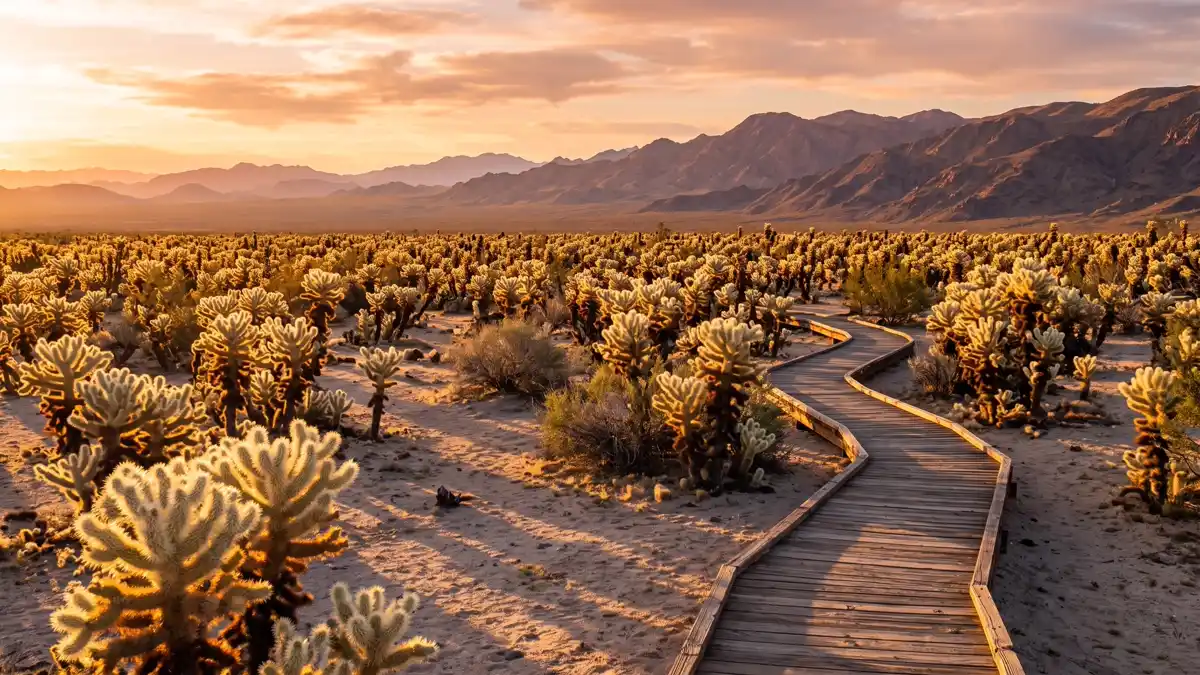
A 10-acre garden of teddy bear cholla cactus along a 0.25-mile boardwalk loop off Pinto Basin Road. At sunrise and sunset, the spines catch the light and glow gold against the distant mountains — it's the single most photographed spot in Joshua Tree. This garden also marks the ecological boundary where the Mojave Desert transitions into the Colorado Desert, which is why the plant life changes so dramatically as you drive south.
Otherworldly golden-hour photography, and the exact spot where two deserts meet.
Sunrise or sunset for the golden backlit spines. Midday works but lacks the magic.
Restroom facilities nearby — see map above
2Keys View
Iconic SightEasy — short paved walk from parking lot, wheelchair accessible
Keys View
Iconic SightEasy — short paved walk from parking lot, wheelchair accessible
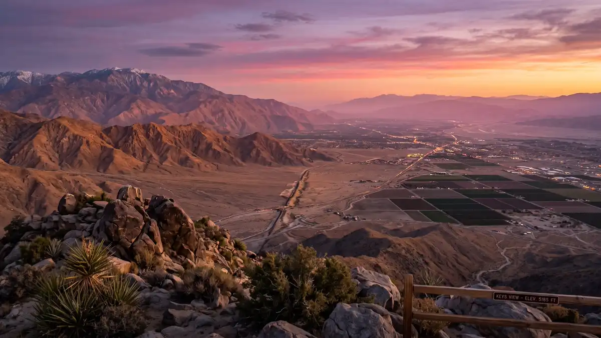
At 5,185 feet, this panoramic overlook delivers one of the most dramatic views in the California desert. On clear days, you can see the Coachella Valley sprawling below, the San Andreas Fault line cutting across the landscape, the Salton Sea glinting 60 miles south, and even Mexico's Signal Mountains. The paved path from the parking lot is wheelchair accessible.
The park's single most dramatic viewpoint — connects geology, fault lines, and desert geography in one sweeping panorama.
Late afternoon or sunset. West-facing, so the light improves as the day ends.
Restroom facilities nearby — see map above
3Skull Rock
Iconic SightEasy — visible from the road, with a 1.7-mile loop trail
Skull Rock
Iconic SightEasy — visible from the road, with a 1.7-mile loop trail
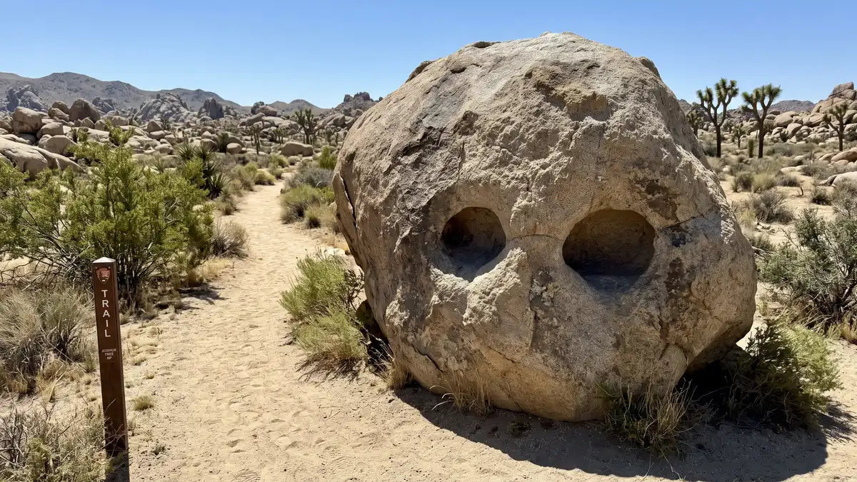
The park's most recognisable formation, sitting right beside Park Boulevard. Centuries of water erosion carved two hollow eye sockets into this massive boulder, giving it an unmistakable skull shape. A 1.7-mile loop trail starts here and winds through a surreal landscape of jumbled boulders and Joshua trees.
Instantly recognisable, zero effort to reach, and the loop trail is one of the park's best short walks.
Morning for dramatic angular light on the formation. Avoid midday flat light.
Restroom facilities nearby — see map above
4Hidden Valley
Iconic SightEasy — 1-mile flat loop trail
Hidden Valley
Iconic SightEasy — 1-mile flat loop trail
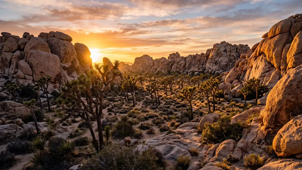
A boulder-enclosed valley that 19th-century cattle rustlers allegedly used to hide stolen livestock — the narrow entrance between the rocks made it a natural corral. Today, the 1-mile loop trail through the valley floor passes some of the densest Joshua tree groves in the park. At sunset, the combination of golden light on the boulders and the silhouettes of the trees creates what photographers consider the best light in Joshua Tree. This is also ground zero for the park's legendary rock climbing scene — routes start right from the valley floor.
Best sunset photography in the park, combined with outlaw history and climbing culture.
Late afternoon through sunset. Also excellent at sunrise for soft directional light.
Restroom facilities nearby — see map above
5Arch Rock
Iconic SightEasy — 0.5-mile trail from White Tank Campground
Arch Rock
Iconic SightEasy — 0.5-mile trail from White Tank Campground
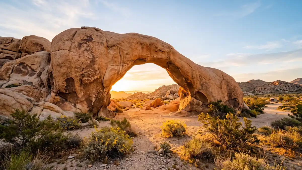
A natural granite arch in White Tank Campground, reached by a short 0.5-mile trail. The arch creates a perfect natural frame for both sunrise photography and night sky shots — the Milky Way arcs beautifully through the opening. Arrive before dawn for the best sunrise compositions, when warm light pours through the arch and illuminates the desert floor beyond.
The park's best sunrise spot and a prime astrophotography location — one formation, two world-class photo opportunities.
Pre-dawn for sunrise. New moon nights for Milky Way photography.
Restroom facilities nearby — see map above
6Barker Dam
History & NatureEasy — 1.1-mile loop trail
Barker Dam
History & NatureEasy — 1.1-mile loop trail
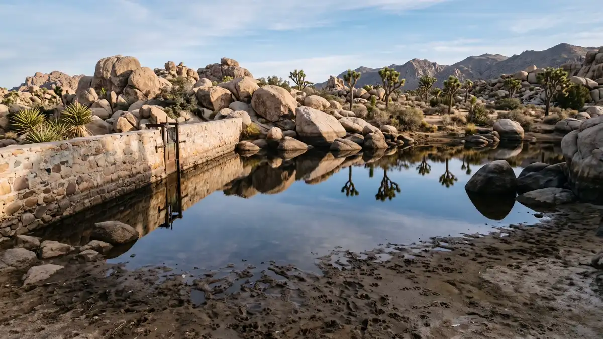
Built by cattle ranchers in the early 1900s to collect rainwater, this dam creates the only reliable surface water in Joshua Tree National Park. In wet years, the reservoir fills and attracts desert bighorn sheep, coyotes, and dozens of bird species — it's the park's best wildlife viewing spot. A short spur trail leads to Native American petroglyphs estimated to be over 2,000 years old, carved into the rock face by the Serrano and Cahuilla peoples.
Water in the desert is extraordinary. Combines ranching history, ancient petroglyphs, and the best wildlife viewing in the park.
Early morning for wildlife sightings. Visit in winter or spring when water levels are highest.
Restroom facilities nearby — see map above
7Ryan Mountain Summit
Summit HikeModerate — 3 miles round trip, 1,050 ft elevation gain, no shade
Ryan Mountain Summit
Summit HikeModerate — 3 miles round trip, 1,050 ft elevation gain, no shade
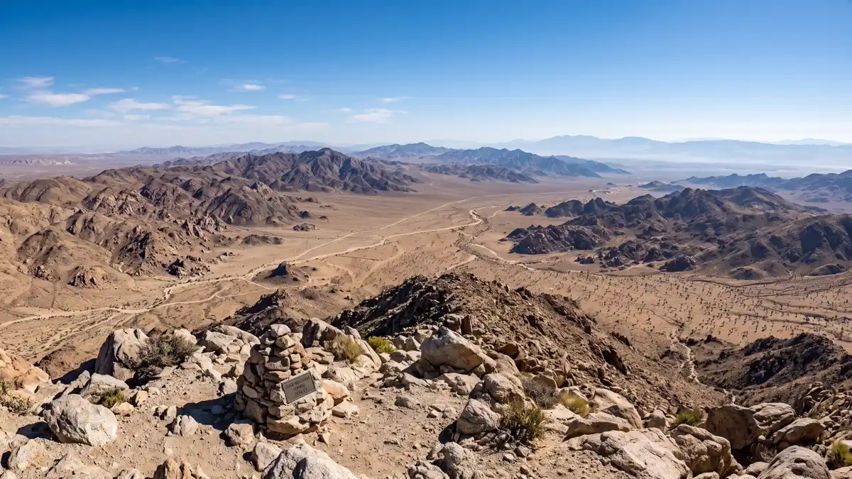
The most rewarding summit hike in Joshua Tree. The 3-mile round trip climbs 1,050 feet to the 5,456-foot summit, where a 360-degree panorama unfolds — the Pinto Basin, Lost Horse Valley, the Queen and Wonderland of Rocks, and distant mountain ranges fading to the horizon. The parking lot is also a designated stargazing area, making this a two-for-one destination.
The best effort-to-reward ratio in the park. The summit view defines the sheer scale of Joshua Tree's 1,200 square miles.
Early morning to avoid heat exposure on the shadeless trail. Sunset from the summit is remarkable but means hiking down in fading light.
Restroom facilities nearby — see map above
8Wall Street Mill
History & CultureEasy — 2 miles round trip, flat terrain
Wall Street Mill
History & CultureEasy — 2 miles round trip, flat terrain
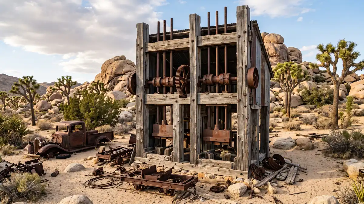
The best-preserved 1930s gold stamp mill in the California desert, reached by a flat 2-mile round trip trail. Along the way, you'll pass rusted vintage cars, an abandoned windmill, and the pink ruins of Wonderland Ranch. But the real story here is Bill Keys — the rancher-miner-homesteader who shot and killed neighbour Worth Bagley in a land dispute on this exact spot in 1943. Keys was convicted of murder and sent to San Quentin, until Erle Stanley Gardner — creator of Perry Mason — took up his case and won a pardon. A memorial marker still reads: 'Here is where Worth Bagley bit the dust at the hand of W.F. Keys.'
A genuine Wild West murder story, preserved mining history, and one of the best easy walks in the park.
Any time — the trail faces east so mornings offer the best light on the mill structure.
9Lost Palms Oasis
Adventure HikeStrenuous — 7.4 miles round trip with off-trail scrambling to reach the oasis floor
Lost Palms Oasis
Adventure HikeStrenuous — 7.4 miles round trip with off-trail scrambling to reach the oasis floor
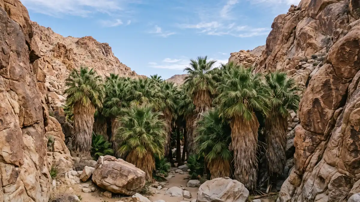
The most remote and most beautiful oasis in Joshua Tree. A 7.4-mile round trip hike from Cottonwood Spring leads through the Colorado Desert landscape to a hidden canyon where over 110 native California fan palms cluster around underground springs. Getting down into the oasis itself requires an off-trail scramble over boulders. The effort required filters out crowds — you may have this extraordinary place entirely to yourself.
The park's most rewarding hike. Over 100 fan palms in a hidden canyon that genuinely feels like a discovery.
October through April only. Do NOT attempt May through September — extreme heat makes this hike dangerous.
1049 Palms Oasis
Hidden GemModerate — 3 miles round trip, 300 ft elevation gain
49 Palms Oasis
Hidden GemModerate — 3 miles round trip, 300 ft elevation gain
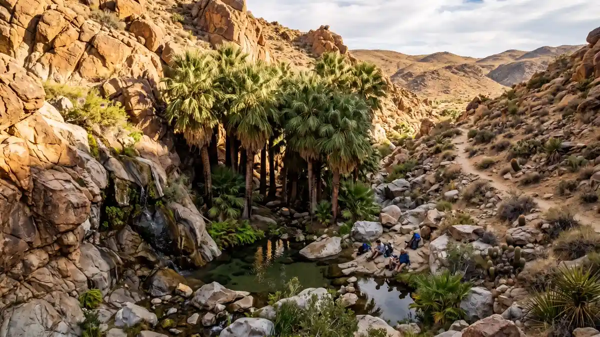
A secluded fan palm oasis accessed from a trailhead outside the park's main road system, near Twentynine Palms. The 3-mile round trip trail climbs through a rocky canyon to reveal a cluster of California fan palms fed by an underground spring. Because the trailhead sits away from Park Boulevard, far fewer visitors make it here — this is the locals' oasis.
Genuine desert solitude. Half the distance of Lost Palms with a fraction of the crowds.
Morning for shade on the return hike. October through April for comfortable temperatures.
11Keys Ranch
History & CultureEasy — guided walking tour on flat ground
Keys Ranch
History & CultureEasy — guided walking tour on flat ground
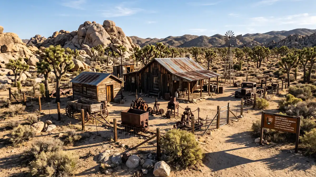
Bill Keys' homestead from 1910 to 1969 — the most complete surviving desert homestead in California. A 90-minute ranger-led tour ($10, reservation required) walks you through the ranch buildings, schoolhouse, workshop, fruit orchard, and wells that sustained one family's life in this unforgiving landscape for nearly 60 years. Tours are limited to small groups and sell out — book ahead.
The most intimate historical experience in the park. A real story of desert survival, told in the buildings where it happened.
Tours run October through May, never on Mondays or Saturdays. Book well in advance.
12Geology Tour Road
Backcountry DriveEasy (driving) — 4WD required past mile 5
Geology Tour Road
Backcountry DriveEasy (driving) — 4WD required past mile 5
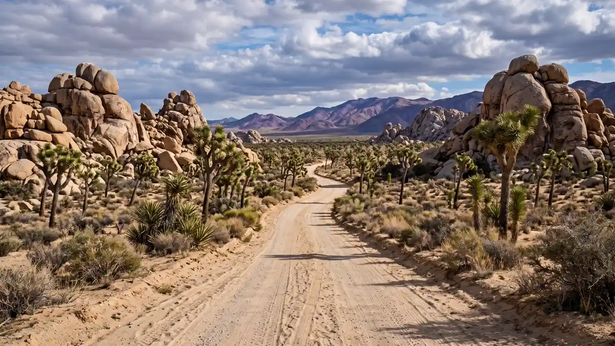
An 18-mile self-guided backcountry drive through the park's geological story, with 16 numbered interpretation stops. The first 5 miles are paved; after that, you need 4WD. The stops explain alluvial fans, mining ruins, earthquake faults, and the geological forces that shaped the park's signature boulder piles over 100 million years.
The park's best driving experience and the most comprehensive geology lesson. Requires commitment — and a proper vehicle.
Any season, but spring wildflowers along the route add a bonus layer.
Things to Do at Joshua Tree
Joshua Tree is more than a hiking park. It's a climbing mecca, an International Dark Sky Park, and the gateway to one of California's most creative art communities. The NPS data covers 48 official activities, but the real Joshua Tree experience extends well beyond the park boundary.
Stargazing & Night Sky
Milky Way Photography at Pinto Basin
The darkest skies in Joshua Tree are at Pinto Basin, deep in the Colorado Desert side of the park, far from any development. The Milky Way core is visible to the naked eye from late March through October, best between 10 PM and 2 AM. Bring a tripod, set your camera to f/2.8, 15-25 second exposure, ISO 1600-3200, and manual focus to infinity. Joshua tree silhouettes against the Milky Way are the park's signature night photograph.
Sky's the Limit Observatory
A community observatory near the Twentynine Palms entrance hosts free public telescope viewing sessions on Friday and Saturday nights. Volunteers guide you through constellations, planets, and deep-sky objects. Family-friendly and genuinely educational — far better than staring at the sky alone.
Designated Stargazing Areas
The NPS designates four areas for optimal stargazing: Quail Springs, Hidden Valley, Cap Rock, and the Ryan Mountain parking lot. These locations combine dark skies with safe parking and enough space to set up equipment.
Rock Climbing
8,000+ Established Routes
Joshua Tree is one of the world's premier climbing destinations, with over 8,000 established routes and 2,000 bouldering problems across its signature sharp, adhesive granite. The rock texture is unique to Joshua Tree — rougher and more grippy than granite elsewhere, but brutal on skin. If you're used to gym climbing, expect your hands to hurt. The most popular areas are Hidden Valley, Intersection Rock, and Indian Cove.
Climber Coffee at Hidden Valley
On Saturday and Sunday mornings during peak season (October through April), climbers gather at Hidden Valley Campground for Climber Coffee — an informal community tradition running for two decades. Discussions cover route conditions, closures, and park policy. Open to anyone, not just climbers.
The Van Life Climbing Community
Joshua Tree's climbing scene attracts a vibrant van life community, particularly during the cooler months. Climbers park their rigs at campgrounds and spend weeks working routes. The culture is welcoming, communal, and deeply connected to the landscape.
Wildflowers
Desert Wildflower Season
Joshua Tree's wildflower bloom moves uphill from February through May — low elevations first, then middle, then high desert. Peak species include purple sand verbena, orange desert mariposa lily, yellow desert dandelion, and the striking red blooms of beavertail cactus. A superbloom requires a specific recipe: soaking winter rains from October through February, followed by gradual warming without late freezes. Seeds can lie dormant for years — even decades — waiting for exactly the right conditions.
15+ Documented Species
The park hosts over 15 commonly seen wildflower species. Indigenous peoples, particularly the Serrano, used Sand Blazing Star seeds as a food source. The connection between the resinous seed coatings — which dissolve only with sufficient rainfall — and the bloom is one of nature's most elegant timing mechanisms.
Art & Culture Nearby
Noah Purifoy Outdoor Desert Art Museum
Ten acres of large-scale assemblage sculpture built from discarded materials — free, open daily, sunrise to sunset. Purifoy arrived in Joshua Tree in 1989 at age 72 and built until his death in 2004 at age 87. Nothing has been altered since. Born into a sharecropper family in 1917, he was the first African American student at Chouinard Art Institute and co-founded the Watts Towers Art Center. His defining work, '66 Signs of Neon', was built from rubble of the 1965 Watts rebellion. The museum sits down unmarked dirt roads — quite literally in the middle of nowhere desert.
Pioneertown & Pappy and Harriet's
Founded in 1946 as a functioning Western film set where Roy Rogers and Gene Autry filmed by day and relaxed by night. Mane Street (not Main — horses had the right of way) retains wooden facades and saloons. Over 400 people still live here. Pappy and Harriet's Pioneertown Palace is a legendary roadhouse where Paul McCartney has played alongside indie bands. BBQ and live music in a genuine Old West setting — book well in advance.
The Integratron
A wooden dome (38 feet tall, 55 feet around) built without nails or screws, located 20 miles from the park in Landers. Aerospace engineer George Van Tassel began construction in 1953 after claiming an extraterrestrial encounter gave him a formula to rejuvenate cells. Sound bath sessions feature crystal singing bowls tuned to specific frequencies. Sessions sell out three months in advance.
Horseback Riding & Mountain Biking
250-Mile Equestrian Trail Network
Joshua Tree has one of the largest equestrian trail networks in the national park system — 250 miles of trails where horses are permitted. Guided tours are available through operators in the gateway towns.
Mountain Biking on Backcountry Roads
While singletrack trails are closed to bikes, backcountry roads like Covington Flat, Queen Valley, and Eureka Peak offer excellent mountain biking on dirt roads through varied desert terrain.
All 58 Restrooms in Joshua Tree National Park
Every mapped restroom in Joshua Tree, grouped by location type.
Park Facilities(45)
ADA-Accessible Restrooms in Joshua Tree National Park
37 wheelchair-accessible restrooms confirmed across Joshua Tree National Park. Each facility below meets ADA accessibility standards — wider stalls, grab bars, and level access. Download the GPX file to save these locations to your GPS before entering the park.
Campground Restrooms, Showers & Water in Joshua Tree
9 campgrounds with restroom and utility details.
Tap any campground name to fly to it on the map above.
| Campground | Restrooms | Showers | Water | Dump Station |
|---|---|---|---|---|
| Vault Toilets - year round | No | No water | No | |
| Flush Toilets - year round | No | Yes - year round | Yes - year round | |
| Flush Toilets - year round | No | Yes - year round | Yes - year round | |
| Vault Toilets - year round | No | No water | No | |
| Vault Toilets - year round | No | No water | No | |
| Vault Toilets - year round | No | No water | No | |
| Vault Toilets - year round | No | No water | No | |
| Vault Toilets - year round | No | No water | No | |
| Vault Toilets - year round | No | No water | No |
Trailhead Restrooms & Hiking Facilities in Joshua Tree
15 trailheads with restrooms. Plan accordingly — most trails have no facilities beyond the trailhead.
Once you leave the trailhead, there are typically no restroom facilities on the trail itself. Plan your stops before heading out.
Oasis of Mara Trailhead
Hidden Valley Trailhead
Split Rock Trailhead
Barker Dam Trailhead
Ryan Mountain Trailhead
Fortynine Palms Oasis Trailhead
Arch Rock and Twin Tanks Trailhead
Lost Horse Mine Trailhead
Pine City Trailhead
Wall Street Mill Trailhead
Bighorn Sheep (Barker Dam Trailhead)
Arch Rock (Arch Rock Trailhead)
Lost Horse Loop Trailhead
Indian Cove Trailhead
Lucky Boy Loop Trailhead
Hiking Trails (25)
| Trail | Distance | Difficulty | Type | Season | Trailhead Restroom |
|---|---|---|---|---|---|
Hike Cholla Cactus Garden | — | — | WinterSpringSummerFall | ✗ | |
Hike Skull Rock | — | — | WinterSpringFall | ✗ | |
Hike Boy Scout Trail | — | — | WinterSpringSummerFall | ✗ | |
Hike Fortynine Palms Oasis | — | — | WinterSpringFall | ✓ | |
Hike Barker Dam Trail | — | — | WinterSpringSummerFall | ✓ | |
Hike Indian Cove Trail | — | — | WinterSpringSummerFall | ✓ | |
Hike Hidden Valley Trail | — | — | WinterSpringSummerFall | ✓ | |
Hike Hi-View Trail | — | Moderate | — | WinterSpringFall | ✗ |
Hike Oasis of Mara | — | — | WinterSpringSummerFall | ✓ | |
Hike Panorama Loop Trail | — | — | WinterSpringFall | ✗ | |
Hike Minerva Hoyt Trail | — | — | WinterSpringFall | ✗ | |
Hike Willow Hole | — | — | WinterSpringFall | ✗ | |
Hike Contact Mine | — | — | WinterSpringFall | ✗ | |
Hike Lost Horse Mine | — | — | WinterSpringFall | ✓ | |
Hike West Side Loop | — | Moderate | — | WinterSpringFall | ✗ |
Hike Cottonwood Spring | — | — | WinterSpringSummerFall | ✗ | |
Hike Cap Rock | — | — | WinterSpringSummerFall | ✗ | |
Hike Bajada Trail | — | — | WinterSpringFall | ✗ | |
Hike Arch Rock | — | — | WinterSpringFall | ✓ | |
Hike Wall Street Mill | — | — | WinterSpringFall | ✓ | |
Hike Pine City Trail | — | — | WinterSpringFall | ✓ | |
Hike Mastodon Peak | — | — | WinterSpringFall | ✗ | |
Hike Split Rock | — | — | WinterSpringFall | ✓ | |
Hike Ryan Mountain | — | — | WinterSpringFall | ✓ | |
Hike Lost Palms Oasis | — | — | WinterSpringFall | ✓ |
Sorted by distance (shortest first). Check the trailhead for current restroom availability.
Visitor Centers with Restrooms in Joshua Tree
4 visitor centers — all with ADA-compliant restrooms.
All visitor centers have ADA-compliant restrooms with running water.
Located in the heart of the beautiful Black Rock Campground, the Nature Center offers a bookstore, art gallery, visitor resources, and a picnic area. Visitors can chat with a park ranger, shop at the bookstore, and observe exhibits in the art gallery. There is also a water-bottle filling station and
The Nature Center is open seven days a week from 8:00-11:00am and 12:00pm-4:00pm. It is closed from 11:00am - 12:00pm. Hours may vary depending on staff availability, especially in the summer. Summer
Located on Pinto Basin Road, approximately 7 miles north of Interstate 10 (exit 168), the Cottonwood Visitor Center is a convenient stop for those entering and exiting the park from the south. It has educational exhibits, a bookstore, visitor resources, and restroom facilities. You can grab a park m
Open all year.
The Joshua Tree National Park Visitor Center is located in downtown Twentynine Palms and features educational exhibits, a bookstore and giftshop, and visitor information.
Joshua Tree National Park Visitor Center is located in Twentynine Palms, California.
Located in downtown Joshua Tree just five miles from the West Entrance, the Joshua Tree Visitor Center offers educational exhibits, a bookstore, and visitor resources. Grab a park map, buy an entrance pass, and chat with a park ranger to get all your questions answered before heading into the park!
Open all year.
Joshua Tree Entry Fees & Park Hours
Self-Guided Tours in Joshua Tree with Restroom Stops
6 self-guided walking and driving tours through Joshua Tree. Each tour lists the number of stops — if we know a stop has restroom access, we flag it so you can plan your route without surprises.
29 Palms to Joshua Tree Audio Tour
This audio tour starts at the Joshua Tree National Park Visitor Center in the town of Twentynine Palms and ends in Joshua Tree, California. This tour is designed to help visitors explore and learn abo...
Cottonwood to Joshua Tree Audio Tour
This audio tour starts at the South Entrance near Cottonwood Spring and ends in the town of Joshua Tree, California. This tour is designed to help visitors explore and learn about Joshua Tree National...
Geology Tour Road
Learn about the geologic forces that shaped Joshua Tree National Park. This tour is on a rough dirt and gravel road so 4-wheel drive is recommended and high clearance in needed beyond Paac Kü̱vü̱hü̱’k...
Hi-View Walking Tour
The High View Nature Trail is a 1.3 mile loop. Total elevation gain on this trail is 400 feet (122 meters). There are several steep sections with steps. Hiking this trail in a counterclockwise directi...
Joshua Tree to 29 Palms Audio Tour
This audio tour starts at the Joshua Tree Visitor Center in the town of Joshua Tree and ends in Twentynine Palms, CA. This tour is designed to help visitors explore and learn about Joshua Tree Nationa...
Joshua Tree to Cottonwood Audio Tour
This audio tour starts at the Joshua Tree Visitor Center in the town of Joshua Tree and ends at the South Entrance near the Cottonwood Area. This tour is designed to help visitors explore and learn ab...
Explore More National Park Restroom Guides
Every park mapped with restrooms, trails, and downloadable GPX files — plan before you lose signal.
The People of Joshua Tree
5,000 Years of Indigenous History
Joshua Tree sits within the traditional territories of the Serrano, Cahuilla, Chemehuevi, and Mojave peoples. The Oasis of Mara — 'the place of little springs and much grass' in the Serrano language — is considered the first place the Serrano lived on Earth. For thousands of years, these nations used the desert's resources with deep understanding: Joshua trees provided food, shelter, and tools; grinding stones visible throughout the park attest to centuries of seed processing; petroglyphs near Barker Dam connect visitors to over 2,000 years of continuous presence. The desert held profound spiritual significance — a relationship with the land that predates the park's boundaries by millennia.
The Mining Era
Gold and silver drew prospectors to these mountains from the 1870s onward. Over 300 mines operated within what is now the park. Lost Horse Mine generated $5 million in gold over 40 years — the park's most productive claim. Wall Street Mill processed ore for small operations into the 1930s. The mining ruins scattered across the park aren't just historical curiosities — they're monuments to the human drive to extract value from the most inhospitable landscapes.
Bill Keys: The Desert's Last Homesteader
No single figure embodies Joshua Tree's human story like William F. Keys. He arrived around 1910, built a ranch, raised a family, operated mines, and lived on this land for nearly 60 years. In 1943, he shot and killed neighbour Worth Bagley in a land dispute and was convicted of murder. Sent to San Quentin, he was eventually pardoned after Erle Stanley Gardner — the lawyer-turned-author who created Perry Mason — investigated the case and concluded it was self-defence. Keys returned to his ranch and lived there until his death in 1969. His homestead is now a national historic site, accessible only by guided tour.
Two Deserts in One Park
Joshua Tree straddles two distinct desert ecosystems, and understanding the split transforms how you experience the park. The northern half sits in the Mojave Desert — higher elevation (3,000-5,000 feet), cooler temperatures, and dense groves of the park's namesake Joshua trees. The southern half drops into the Colorado Desert — lower, hotter, and dominated by ocotillo, cholla cactus, creosote bush, and palo verde trees. The transition zone is visible at the Cholla Cactus Garden, roughly where Park Boulevard meets Pinto Basin Road. Driving south past this point, the Joshua trees thin out and disappear entirely, replaced by a sparser, hotter landscape. The practical difference: the Mojave side is where most visitors spend their time (Hidden Valley, Skull Rock, Keys View), while the Colorado side offers solitude, oases, and a different kind of beauty.
When to Visit Joshua Tree
October – November
Smaller crowds, mild temperatures (60s-80s°F days, 40s-50s°F nights), extraordinary photography light. Peak climbing season begins. The desert cools enough for comfortable all-day hiking.
December – February
Temperatures in the 40s-60s°F during the day, much colder at night. Can snow unexpectedly. Wind is the main enemy — multiple campers report midnight wind events. But: fewest crowds, stunning clear-sky views of distant peaks (San Jacinto at 10,834 ft, San Gorgonio at 11,503 ft), and the Salton Sea. Prime stargazing season.
March – May
The bloom moves uphill from February through May. A superbloom requires soaking winter rains followed by gradual warming. Temperatures rise through the season — by late May, hiking becomes uncomfortable. Spring break crowds can be significant.
June – September
Triple-digit temperatures. Not recommended for hiking — heat-related emergencies are common. But: best Milky Way photography season (the galactic centre is directly overhead June through August), and you may have the entire park to yourself.
Essential Tips
Cell Service
Nearly nonexistent inside the park. Only Black Rock Campground area has reliable signal. Download offline maps (Google Maps, Gaia GPS, AllTrails) before entering. Screenshot our trail map as a backup — this is the #1 lesson from park reviews.
Water
Only Black Rock Campground, Cottonwood Campground, and visitor centres have potable water. There are no water sources on trails. Carry more than you think — one hiker reported drinking 2.5 litres on a 65°F January day.
Ravens
Ravens are the real threat to your gear. They peck through plastic water bottles and can access poorly secured food. Never leave water or food visible in your vehicle — they will break in.
The Drive-Through Strategy
For a single-day visit, enter at the West Entrance (Joshua Tree town), drive Park Boulevard to Pinto Basin Road, and exit at the South Entrance (Cottonwood). This linear route covers both deserts, passes most major sights, and avoids backtracking.
Wind at Night
Wind is the #1 campground complaint. Multiple campers report midnight wind events that threaten to collapse tents. Stake everything, weight everything, bring earplugs.
Joshua Tree National Park Restroom FAQs
Are there restrooms in Joshua Tree National Park?
Are restrooms in Joshua Tree ADA accessible?
Does Joshua Tree have showers?
Is there drinking water in Joshua Tree?
What types of restrooms are in Joshua Tree?
Are restrooms open in Joshua Tree during winter?
Do campgrounds in Joshua Tree have restrooms?
Do visitor centers in Joshua Tree have restrooms?
Restrooms Near Joshua Tree
Gateway towns with public restrooms just outside park entrances.
More National Park Restroom Guides
Park data provided by the National Park Service (public domain). Facility availability may change seasonally.